17 March 2026
New Jersey earthquake in 2024 helps us prepare for future East Coast quakes
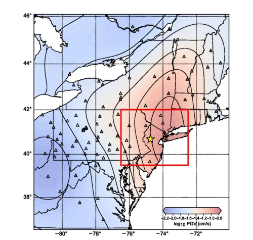
Knowing how much the ground will shake requires a good model of seismic velocity.