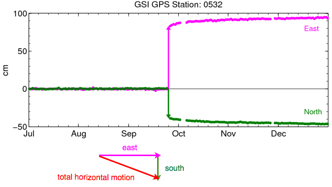
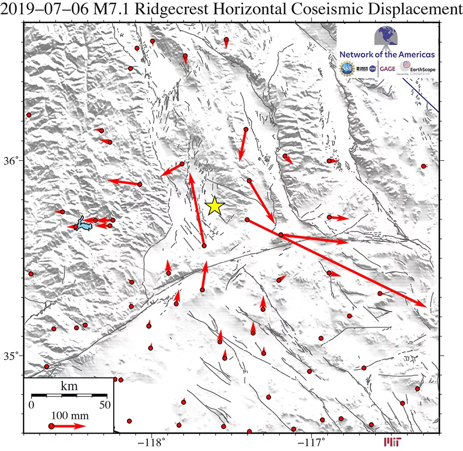
GPS can be used to determine the position of each station in a network very precisely, which enables us to determine exactly how much ground movement there was during an earthquake. This information is used to inform models of fault slip.
Applications for GPS during earthquakes go further than simply determining the location of a station before and after a seismic event. One way to use these data is to calculate a very precise daily position by averaging 24 hours of measurements, but advanced error corrections now make it possible to calculate useful position measurements each second—or less. Certain techniques can even allow the GPS receiver to act like a seismometer, measuring shaking.


Geodetic GPS stations also allow us to measure long-term motion near faults between earthquakes as strain accumulates, monitoring the evolving seismic hazard.
GPS has become particularly important for earthquake monitoring because of its applications to earthquake early warning systems, so that people can be warned about earthquakes and tsunamis to take protective actions. Earthquake early warning systems have traditionally relied on seismometers to record seismic waves so we can estimate the magnitude of the earthquake and the location of its epicenter. Given that information, ground motion prediction models can estimate shaking for locations farther away and send warnings before the seismic waves get there.
Inertial sensors like seismometers, which measure changes in velocity or acceleration, struggle with low frequency motion and can saturate for exceptionally strong motion (like a microphone clipping for loud sounds).This means that the data obtained by seismometers in the initial seconds of an earthquake are insufficient to determine if it will grow into a large, magnitude 8 or higher event. This can cause the earthquake early warning system to initially underestimate the magnitudes of very large earthquakes.
For example, this occurred during the 2011 M9.1 Tohoku-Oki, Japan earthquake. Within the first 30 seconds, the earthquake early warning system estimated the magnitude at 6.8, growing to 7.2 and 8.0 over the next two minutes, but still underpredicting the true shaking and tsunami height that followed.
Geodetic GPS stations can improve the problems faced by earthquake early warning systems by complementing seismometers, as they are able to measure slower displacements and have no upper limit on severity. Real-time GPS stations are particularly useful for earthquakes greater than magnitude 7.0, where seismometers start to struggle, though they cannot detect weaker earthquakes that seismometers are sensitive to. Combining the two types of sensors ensures that an earthquake early warning system can rapidly and accurately detect earthquakes of any magnitude.

