Groundwater fills the small gaps between sediment grains or cracks in rock, forming continuous layers called “aquifers” that can be tapped with wells–a crucial portion of the water supply. The water level of an aquifer can rise and fall just like one’s bank account. During times of drought or excessive well pumping, the water level can fall. During periods of wetter weather or reduced well pumping, the water level can rise. Tracking these changes is crucial to sustainability.
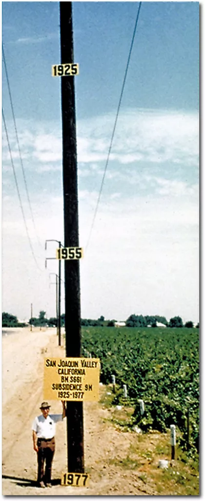
Some groundwater loss can even be reversible, as sediment compacts and closes up the previously water-filled gaps, reducing the aquifer’s capacity. As a result of this compaction, the surface drops in elevation–a phenomenon called “subsidence”. This is (famously) a significant problem in California’s Central Valley, where groundwater depletion led to surface subsidence of more than 9 meters between 1925 and 1977!

On the other hand, areas without such deep sediment aquifers can experience something quite different, though a bit more subtle. Although we perceive bedrock to be firm and unyielding, Earth’s crust is subject to buoyancy-like forces as it sits on top of the deformable mantle. (This is called “isostasy”.) If you add a huge mass to the crust in an area, it will actually depress downwards like a boat carrying extra weight.
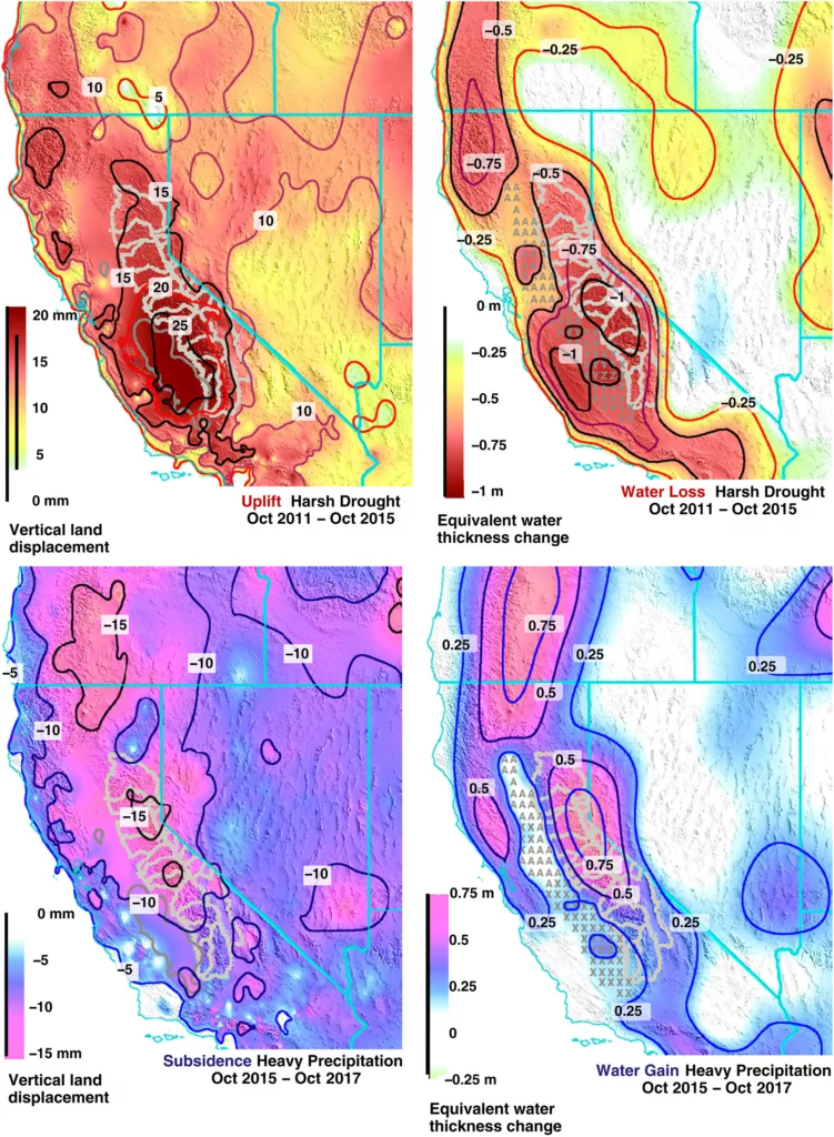
Changes in water resources can move enough mass to make this effect measurable. So groundwater depletion during a drought, for example, can cause bedrock to rise subtly. And conversely, increasing groundwater levels can cause bedrock to sink downward slightly.
Because GPS instruments can measure surface elevation change, they can be used to track both sediment compaction and isostatic bedrock movement linked to groundwater levels. With a network of continuous GPS instruments (like the Network of the Americas), we have a tool to monitor changes across a region.
The figure below, for example, uses the movement of GPS stations attached to bedrock around California to estimate groundwater changes during a prolonged drought (top) and a wet period (bottom).

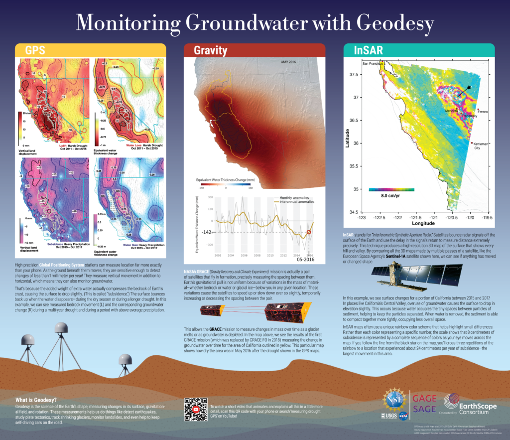
This is not the only way that geophysical data can be used to track groundwater change. InSAR satellites can also measure subtle surface elevation changes across broad areas, making it an excellent tool for measuring surface subsidence from sediment compaction. And NASA’s GRACE satellites actually use minute changes in the strength of gravitational attraction from the Earth to measure mass changes in the area beneath them. To learn more, check out our poster!


