
When Scottish doctor Alexander Fleming discovered penicillin in 1928, it was by accident: what would eventually become a life-saving antibiotic began as a contaminant on his bacterial samples. He wasn’t alone. Science is full of these kinds of “happy accidents,” where a frustrating error can simultaneously be a breakthrough discovery. One such instance — this time in the world of geophysics — may prove to be key in helping us better predict the path of rainfall.
This case of scientific serendipity concerns the Global Navigation Satellite System, or GNSS (a term that encompasses GPS and international positioning systems). GNSS forms the basis of modern positioning and navigation: as you read this, a fleet of satellites soaring overhead is sending out radio signals that are harnessed by GNSS receivers — like the one in your phone — to triangulate your location. And by anchoring permanent GNSS stations into Earth’s crust, scientists can use the system much more precisely to learn how the Earth is deforming under our feet. But GNSS doesn’t come without its errors — one of the largest being the delay that the signal experiences as it travels through the troposphere, the lowest layer of our atmosphere (and the zone where weather occurs).
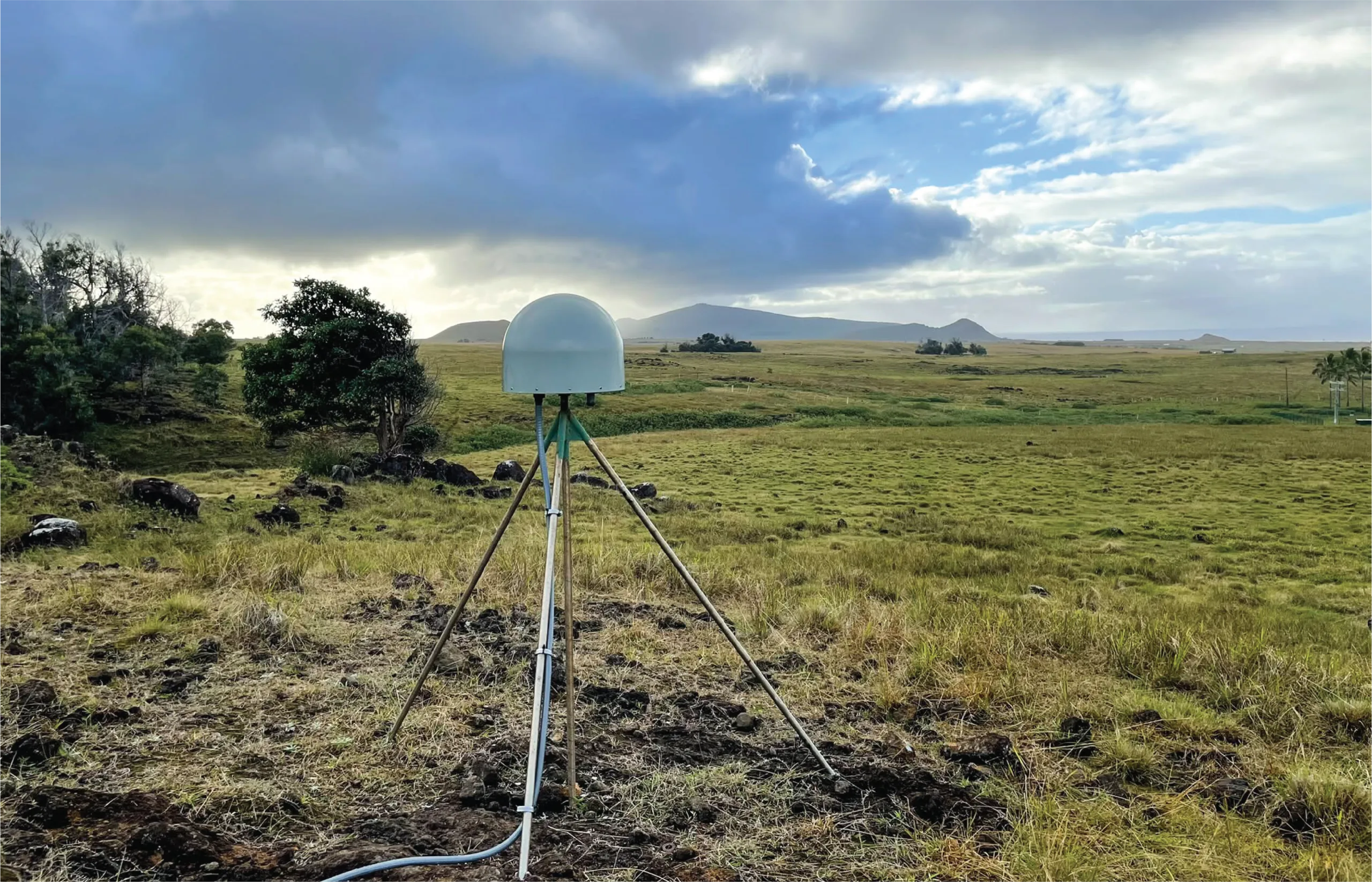
Ninety percent of this delay is due to dry gas and is relatively simple to correct; the remaining 10%, caused by atmospheric water vapor, is impacted by a location’s particular weather patterns and is much tougher to pin down. But this “wet delay” — a bane to GNSS positioning calculations — can be a blessing for meteorologists and atmospheric scientists. Based on this delay, it’s possible to calculate the total water vapor in the area above a specific GNSS station; as the occurrence of rainfall depends on the amount of water vapor in the atmosphere, this calculation helps scientists understand the likelihood of precipitation events. Vapor measurements from GNSS networks (like the Network of the Americas) have been integrated into weather forecasting models and have shown promise in monitoring natural disasters like monsoons and hurricanes.
This feature of GNSS underpins a new study published in Geophysical Research Letters, in which a team led by Dr. Cuixian Lu at Wuhan University developed GRENet, a deep learning model that incorporates GNSS-based water vapor calculations with the goal of improving “precipitation nowcasting.” The accuracy of this type of rapid-response forecasting — which is run repeatedly to predict a location’s rainfall over the next minutes to hours — is crucial for early warning systems and in preparing for intense storms.
Anticipating a storm’s next moves
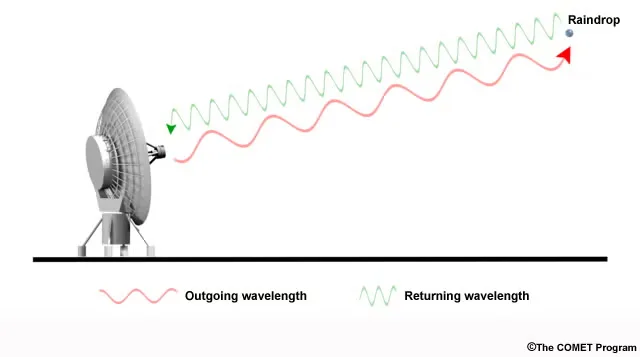
Traditional precipitation nowcasting relies on radar systems, in which an antenna shoots short bursts of radio waves outwards into the atmosphere; if these traveling waves meet raindrops or other precipitation, part of the signal gets “echoed,” or reflected back, towards the antenna. Based on the strength of this incoming echo and the time it took to return, the system can calculate the amount of precipitation and its location.
Anyone who’s seen TV meteorologists gesture at colored maps can recognize that radar-based predictions are a foundational tool in modern forecasting. Traditional nowcasting techniques like optical flow use radar reflectivity to capture a snapshot of an area’s current rainfall and then extrapolate it linearly to predict the next “frame.” With the meteoric rise of artificial intelligence capabilities, scientists around the world have begun incorporating radar observations into machine learning models; unlike conventional techniques that only see the “now” of rainfall, these models are trained on past data to better predict the complex, nonlinear evolution of storms.
These radar-based deep learning algorithms, however, aren’t “meteorologists,” taking into account physical observations about the atmosphere: instead, they rely heavily on historical trends and patterns. This is where GNSS comes in to help. The idea behind GRENet is that incorporating physical parameters that impact precipitation occurrence (like water vapor content) could improve these models’ performance, providing guidelines to anchor their predictions.
A vapor-infused model
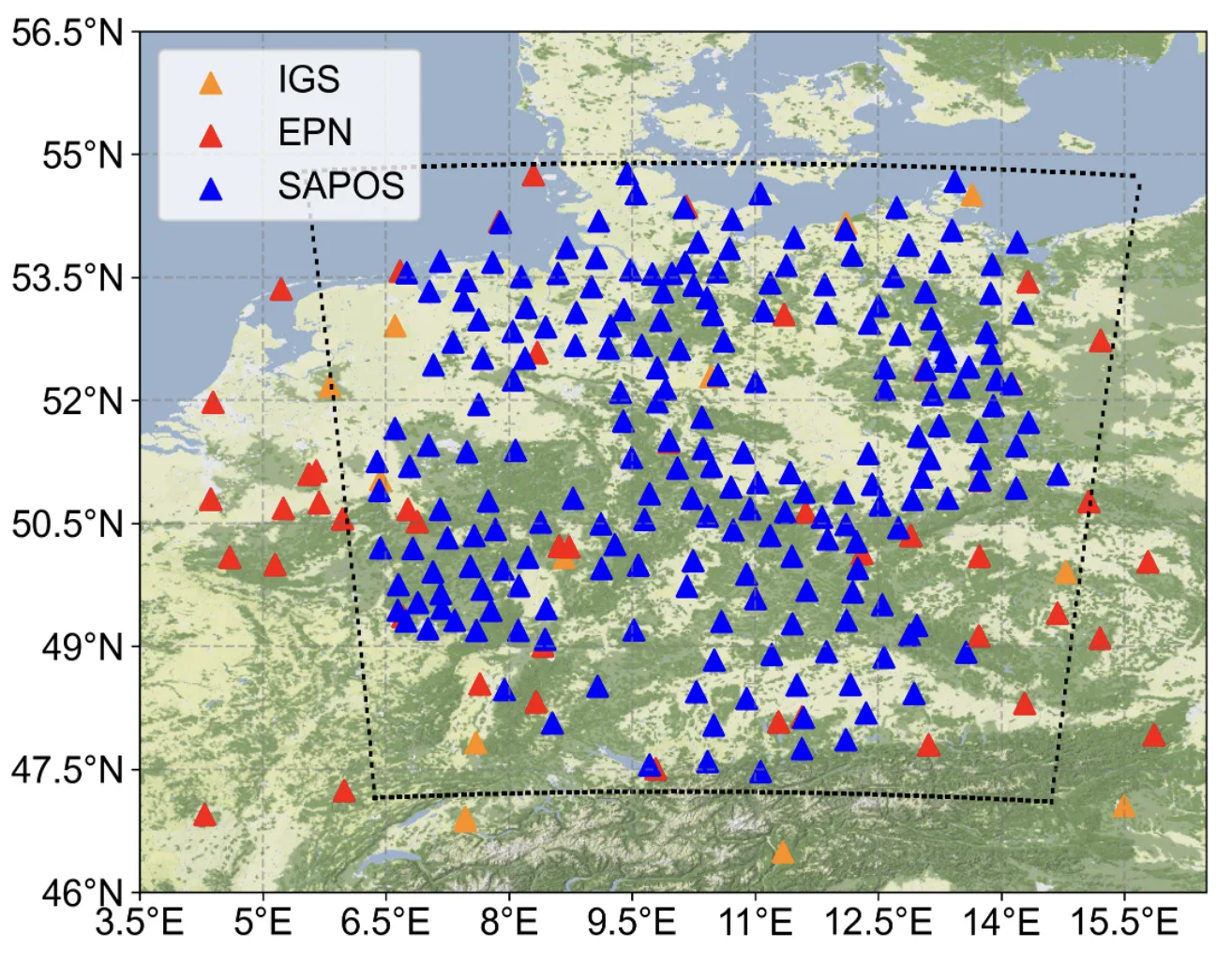
To develop GRENet, the scientists created a framework to incorporate GNSS water vapor observations into a radar-based deep learning model. The team then put GRENet to the test by evaluating its ability to “predict” a suite of past German storms. To create these predictions, the team fed real water vapor data from nearly 300 permanent GNSS stations across Germany into GRENet. They carried out a detailed case study on one 2016 heavy rainfall event, then further evaluated the model on a series of summer and winter storms from 2016 and 2017.
The researchers compared GRENet’s forecasting abilities to a traditional radar-based “optical flow” model and a radar-only deep learning model “baseline,” evaluating how well these approaches predicted real events — the “ground truth” — to assess each model’s ability to capture reality and thus nowcast real rainfall.
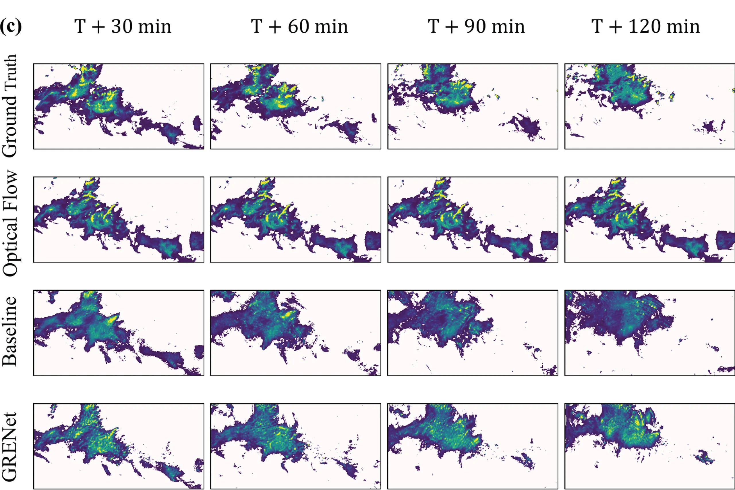
GRENet showed an overall improvement in performance compared to either of the radar-only models, especially in predicting rainfall evolution at the higher end of the tested timeframes.This vapor-infused model was best at forecasting summer storms and rainfall of low to medium intensity — where water vapor content is more likely to dictate the precipitation’s behavior. GRENet didn’t perform as well in predicting high-intensity rainfall events, where precipitation is generally controlled by the strength of vertical air movement generated by atmospheric phenomena like passing cold fronts.
In future iterations of GRENet, the researchers are looking to incorporate other parameters like three-dimensional vapor data to better capture the movement of water in the atmosphere. They also plan to explore a more sophisticated data processing strategy to further improve the model.
As worldwide weather events become more extreme, the accuracy of precipitation nowcasting will become increasingly crucial — and the unexpected benefit of GNSS’s “vapor vision” could be instrumental in pushing this field forward.