A handheld GPS device like you carry on a hike might give you your coordinates plus-or-minus 3 meters (or 10 feet). But a geodetic GPS station knows its location within about a centimeter (less than half an inch) and can measure gradual changes of just a millimeter per year. This increased precision is part hardware, and part calculation.
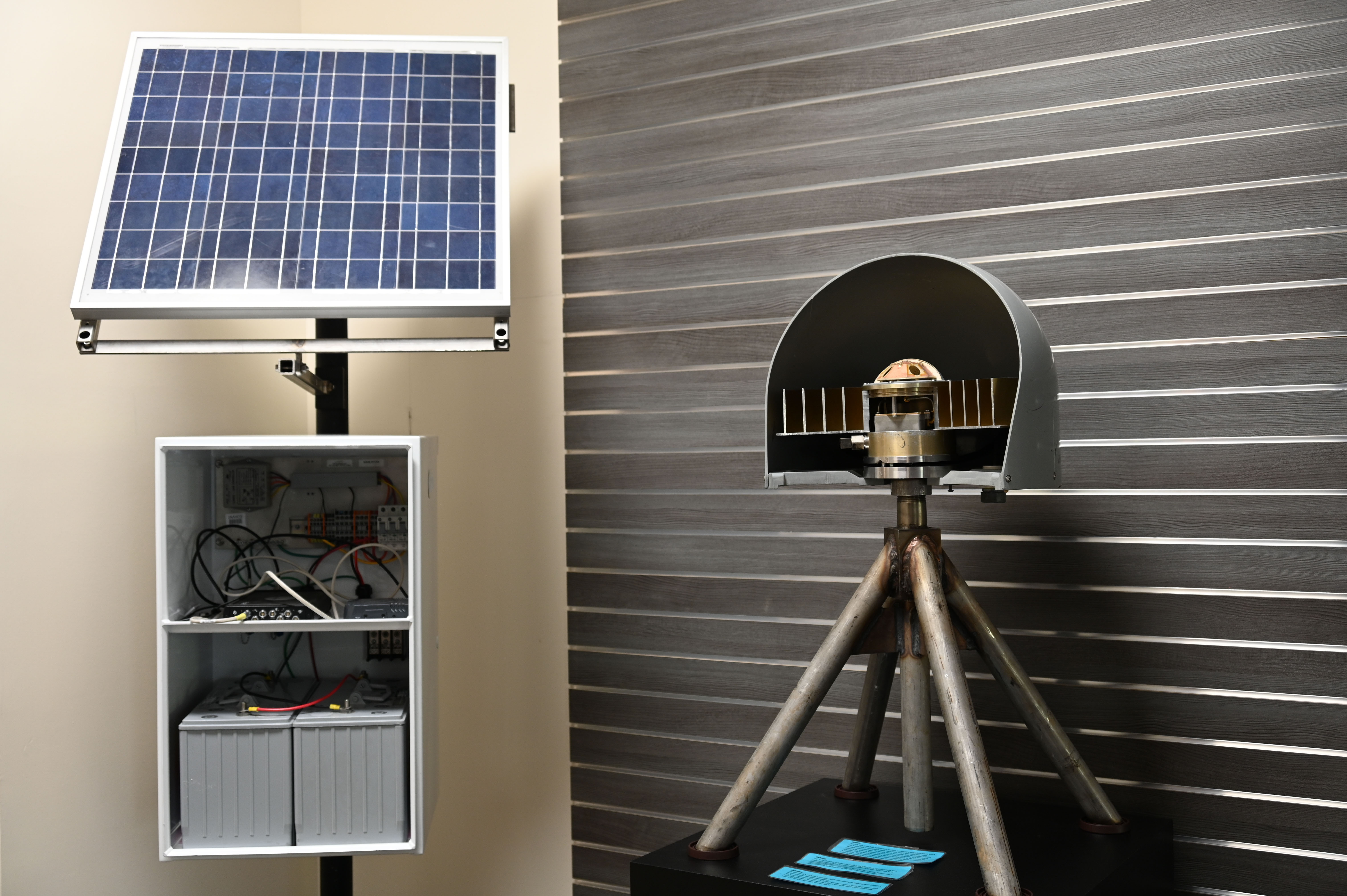
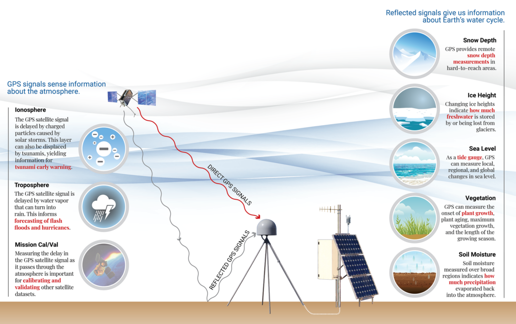
These stations consist of solar panels, batteries and electronics in a steel cabinet, and a distinctive antenna with a dome-shaped cover. The antenna is mounted on legs that are driven or drilled into the ground, providing a rock-solid base that only moves when the Earth does.

That specialized antenna does an excellent job of picking up signals from navigation satellites—whether from the US-operated GPS satellites or other GNSS constellations like Russia’s GLONASS and China’s BeiDou satellites. Inside the cabinet, a small device called a receiver uses those signals to calculate the antenna’s distance from each satellite, working out its exact position in three-dimensional space.
Part of the increased accuracy of this setup comes from the simple fact that the station is, well, stationary. The error bars on your position (like plus-or-minus 10 feet) are caused by a number of factors, including atmospheric conditions that refract the satellite signal, delaying its arrival at your antenna. By averaging many position measurements over time, the error bars are progressively reduced. Using multiple navigation satellite constellations speeds this process up since there are more satellite signals to use at a time.
But geodetic GPS instruments also have an important trick up their sleeve. They don’t just use the digital data broadcast by satellites—they also analyze the radio frequency signal used to carry the data. The message a satellite broadcasts relays its position and the exact time, allowing the receiver to calculate its distance from the satellite based on the length of time the signal took to travel. Because this chunk of information takes a chunk of time to fully transmit, this can only be used to calculate position to within about a meter.
The radio signal carrying that information is an oscillating sine wave with a frequency over 1 billion cycles per second. By counting the cycles from the start of a message, and measuring the phase within a cycle, the receiver can use much finer slices of time to calculate distance to satellites more precisely.

GPS position data can also be processed after the fact to improve accuracy. Tiny corrections to the synchronization of the clocks onboard the satellites, and to the satellite’s exact orbit, can tighten up the previous day’s position calculations, for example. Because distance from the satellite is calculated based on the time it took the signal—traveling at the speed of light—to reach your antenna, just a single nanosecond difference between the satellite clocks and ground clocks can throw your estimated position off by about 30 centimeters (or 1 foot). Adjusting any such clock mismatches in past data can remove those errors.
These “final” corrections are made available weekly, but other techniques can be used to get close to that level of accuracy in real time.
A technique called Precise Point Positioning streams estimated corrections to the receiver, applying them to position calculations in the moment. While these aren’t quite as exact as the final corrections, they have a similar effect, reducing the variability of data points so the true position can be measured more precisely.
The Real Time Kinematic technique is slightly different, and is often used when you have a smaller “rover” instrument you are moving around with. This technique uses the nearest stationary instruments (perhaps permanent stations in a network) as a reference. The idea is that the rover and reference instruments are affected by the same atmospheric and ionospheric errors, but the reference instrument’s true position is known much more accurately since there are so many data points to average. That allows the rover to apply a correction based on the reference station in real time.
These are all ways that geodetic GPS measurements differ from the output of simpler handheld navigation devices, resulting in the precision that allows us to study incredibly subtle Earth processes.

