


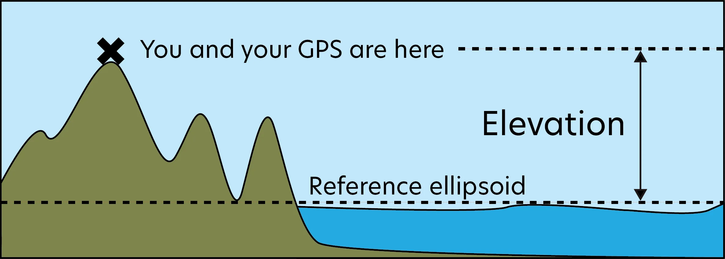
GPS receivers use a smoothed model of sea level to calculate elevation. The model is called a reference ellipsoid. This means that the elevation reading from a GPS receiver is not the vertical distance from true sea level, but rather the distance from the reference ellipsoid. In this tutorial, we introduce the concept of ellipsoids and reference ellipsoids as they relate to GPS measurements.
The Shape of the Earth: An Introduction to the Ellipsoid
Earth is not a perfect sphere; it is more like a slightly squished sphere called an ellipsoid. An ellipsoid looks like a basketball when someone is sitting on it.
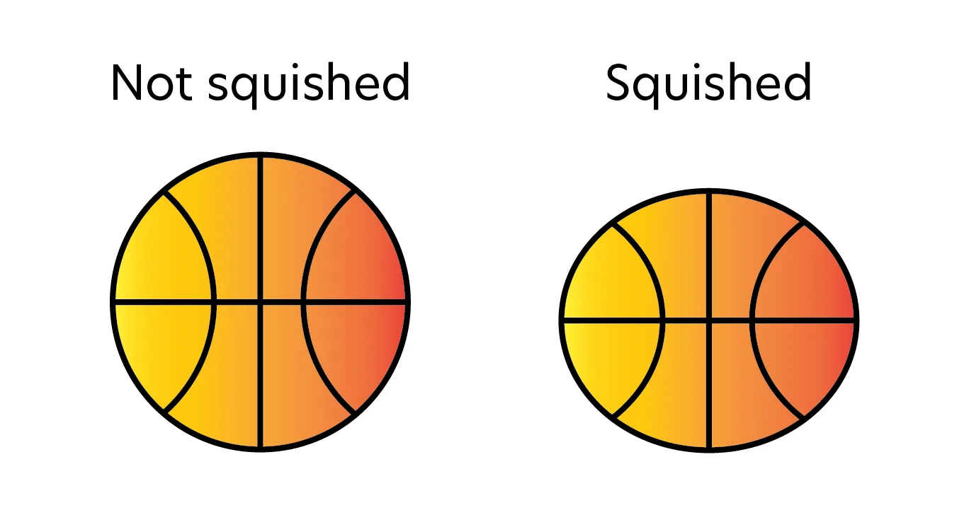
Instead of being perfectly round, Earth is squished, or flattened, between the top and bottom, and bulges out from the sides. Because of mountains and valleys on Earth’s surface, Earth isn’t a perfect ellipsoid, but an ellipsoid is a very close approximation of Earth’s overall shape.
The GPS Receiver and the Reference Ellipsoid Model
A GPS receiver produces latitude, longitude, and elevation values for a given location. Let’s focus specifically on how a GPS receiver calculates elevation. The information required is:
- The locations of at least four satellites in space.
- The current time.
- The shape of the reference ellipsoid.
All GPS receivers use the same reference ellipsoid, the WGS-84 Reference Ellipsoid. The figure below shows this ellipsoid with some lengths in meters for:
- The Semi Major Axis: the distance from the North Pole to the ellipsoid’s center.
- The Semi Minor Axis: the distance from any point on the Equator to the ellipsoid’s center.
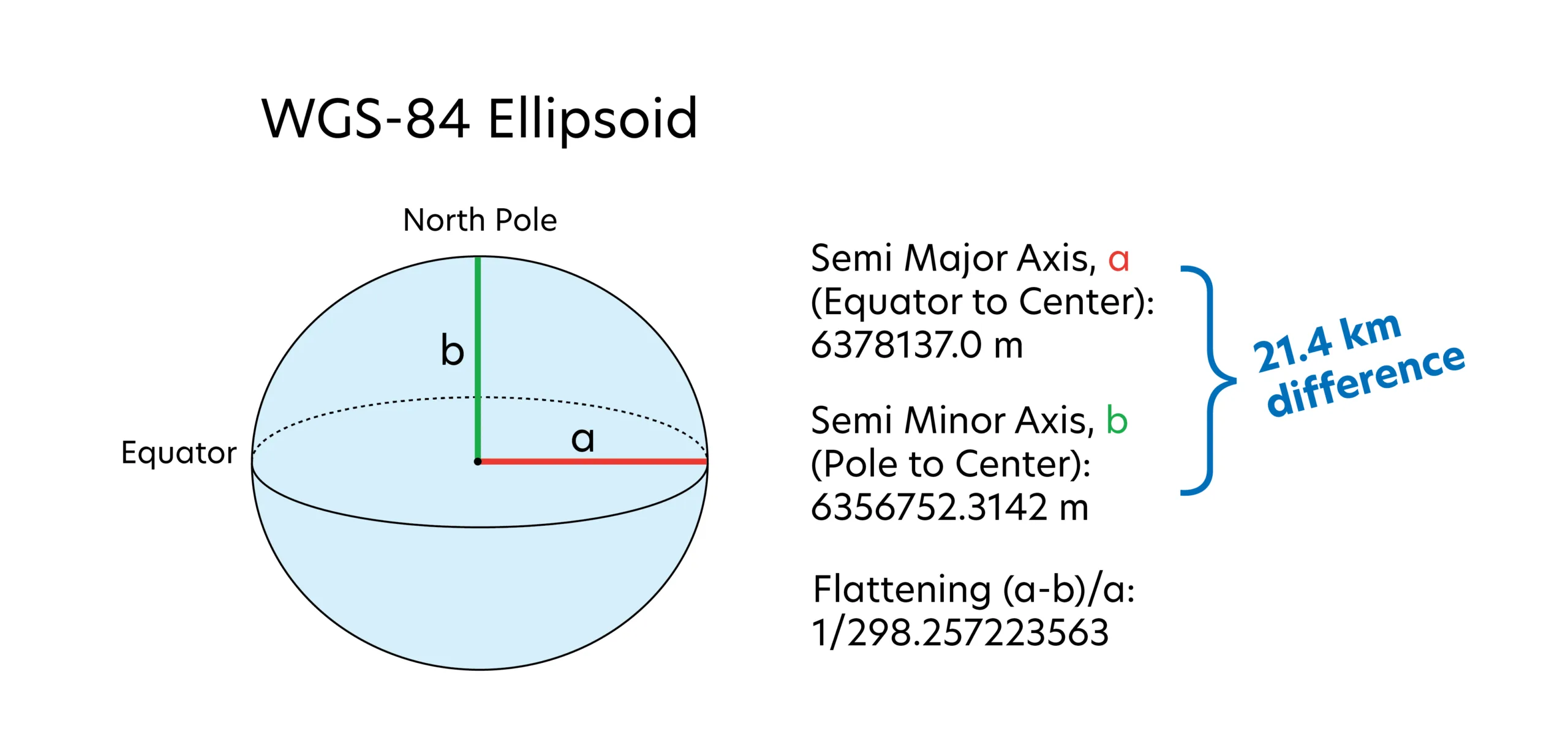
Notice that the Semi Major Axis (a) is longer than the Semi Minor Axis (b). This means that Earth is wider at the Equator than it is between the North and South Poles, like the squished basketball. The lengths shown in the image define the exact shape of this ellipsoid, and are used by GPS receivers to help calculate elevation anywhere on Earth. So, if a GPS receiver reports an elevation of 1,600 meters, what that means is that you are 1,600 meters above the reference ellipsoid.
Models and Their Usefulness in Science
The reference ellipsoid is a simplified model of the world around us. It is a mathematical representation of Earth’s sea level surface and ignores the effects of tides, seasonal currents, and waves. Why, then, would a model be useful in science? In the case presented here, the model (the reference ellipsoid) is helpful in measuring elevation because describing the true shape of sea level is complicated and would involve storing a lot of information within a GPS receiver. Even though it isn’t perfect, the reference ellipsoid allows GPS receivers to approximate elevation precisely enough for it to be useful for the vast majority of human applications.
Using Averages to Increase Accuracy
You may now be wondering, “If GPS receivers use a model that only approximates sea level, what effect does using the model have on how well we know elevations?” Usually, this effect is expressed in terms of accuracy.
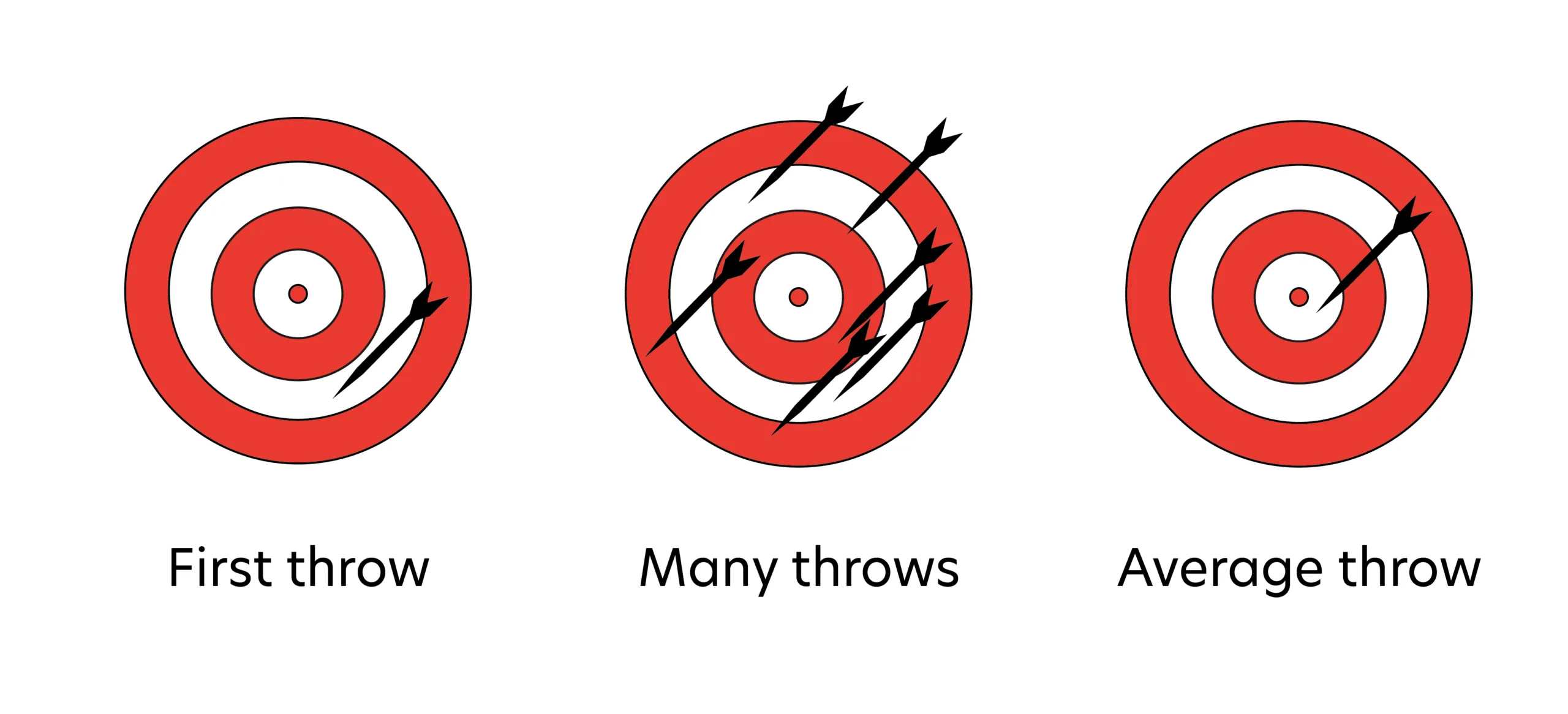
Accuracy is a term used to describe how close a measurement is to a true value. If you think about throwing a dart and aiming for the bullseye, the accuracy of your throw will depend on how close the dart lands to the bullseye; a dart that lands on the edge of the dart board will be less accurate than a dart that lands directly on the bullseye.
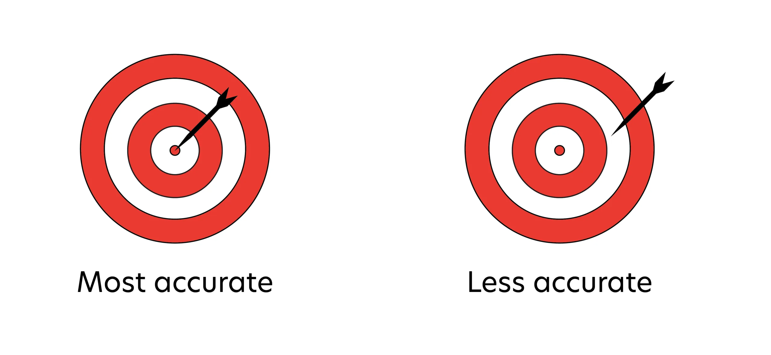
Similarly, the most accurate elevation reading is one that most closely matches the true height of a location above sea level. Since a GPS receiver uses the reference ellipsoid, and not true sea level, to calculate elevation, then the elevation measurement is sometimes less accurate than the true height above sea level. However, there are times when the reference ellipsoid matches true sea level, resulting in a highly accurate elevation.
You may also wonder if there are ways to increase accuracy of GPS measurements. Let’s say you brought a GPS receiver to a study site and you took 15 readings, 1 reading each minute for 15 minutes. As you collected data, the GPS readings probably seemed to wander, and so you used an average of all 15 measurements to get an approximate position. This averaging increased the accuracy of your GPS coordinates from 100 meters to 30 meters.
Another way to visualize this is to consider darts’ positions relative to a bullseye. In the figure below, you can see that even though the player aims for the same location each time (the bullseye), the locations of each dart are varying distances from the target location. Averaging the positions of each dart after six throws produces a position that is closer to the bullseye than any of the individual darts. Thus, averaging multiple positions increases accuracy.
Now we know that GPS receivers use a model called the reference ellipsoid to determine your elevation. To learn more about what using this model means about your elevation measurements, continue to the Geoid and GPS Receivers tutorial.