Put simply, the cryosphere is the portion of Earth’s surface covered by frozen water, including ice sheets, glaciers, and permafrost. SAR and the cryosphere have a long history, with one of the first Earth-observing satellites (Seasat) using SAR to measure polar sea ice conditions. In today’s changing climate, InSAR continues to monitor Earth’s icy surfaces to understand how changes across the cryosphere will impact the rest of the planet.
Ice Sheets
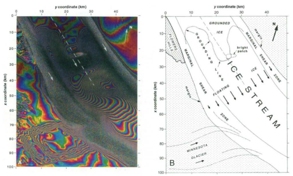
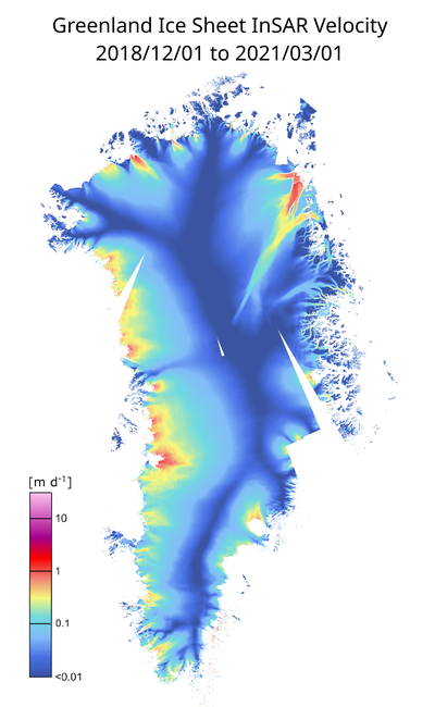
An early use of single interferograms was tracking glacial ice flow in areas such as Antarctica and Greenland. The amount of fringes in the interferograms indicates how much movement has occurred over the ice sheet, and when that is divided by the time spanned by the two dates, a velocity is calculated. Determining ice sheet velocities and tracking them over time is useful because changes in velocity can reveal the ice sheet’s response to climate change and other environmental processes. InSAR data can also indicate the position of the grounding line, which is where a coastal glacier transitions to a floating ice shelf. The grounding line retreats landward as a glacier shrinks, so tracking it over time is critical to understanding how much ice is being lost in these areas.

Modern InSAR continues to track ice sheet movement, but with robust stacks of interferograms that can track velocities over shorter time intervals. This allows for ice velocities to be monitored between seasons and further analysis to be performed on short- and long-term trends.

Permafrost
Areas of permafrost have also been studied with InSAR to understand their stability across winter and summer months and to discern any long-term trends over multiple years. The freezing and thawing cycle of permafrost can be studied with InSAR by finding the timing of maximum subsidence, which indicate when the whole permafrost layer has thawed. The high spatial coverage of InSAR also allows for researchers to determine if large swaths of permafrost are thawing/freezing uniformly or if there is spatial variability across an area.

