


If you’ve ever slipped on loose gravel underfoot, congratulations — you’ve gotten an excellent demonstration of a key way that glaciers move. Sandwiched between ice and the underlying bedrock, a sedimentary layer can create a slippery surface that makes it easier for glaciers to slide. Far from being a simple academic curiosity, these ice-bedrock interface zones provide valuable insights into the effects of climate change.
If you could peer through kilometers of glacial ice and examine an interface zone up close, you would see a complex layer made up primarily of loose sediments and/or weak, water-logged sedimentary rocks. This layer interacts with the ice above it in a variety of ways, from deforming under the glacier’s weight to creating new pathways for subglacial water to flow. Taken together, this mixture of mechanisms serves as a kind of “conveyor belt” that scoots the ice forwards.
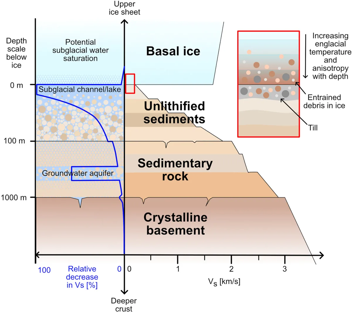
Understanding how these ice giants move can help us predict their futures — fates that are becoming all the more uncertain amid the existential threat posed by warming seas. This knowledge is particularly critical for the massive glaciers that make up the Antarctic Ice Sheet, which contains roughly 90% of all of the ice on Earth and is a major contributor to global sea level rise. This enormous ice sheet flows continuously into the surrounding ocean, where chunks of ice break off and are set adrift. But how do we study the subglacial motor behind much of this movement?
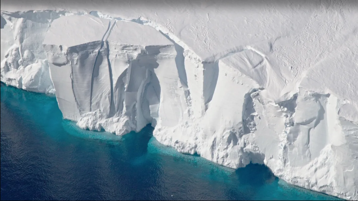
Scientists have typically investigated subglacial interface zones by drilling through the ice, but this kind of fieldwork is expensive and logistically complicated. A new study published in JGR Solid Earth uses seismic data from the NSF NGF archive to present an alternative: harnessing ocean seismicity to look for the characteristic fingerprints of these subglacial layers. In doing so, they add another tool to the toolkit necessary for tracking the movement of these glacial goliaths.
Seismic slowdown
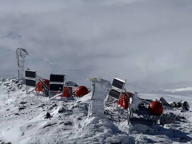
Though you may think of seismicity in the context of massive earthquakes, everything from a whale’s call to songs and cheers at a Taylor Swift concert can produce seismic signals. The churning of ocean waves on the seafloor creates a constant low-level hum of seismic “background noise” that can be detected by seismometers. When these receiver stations are placed on top of ice sheets, scientists can use the speed and strength of this incoming ocean-generated hum to learn about the underlying ice.
But what does this have to do with subglacial interface zones? If oceanic seismic waves hit sedimentary layers on their journey from seafloor to receiver, they slow down — it’s like encountering a 15-mph school zone on a typically 35-mph section of your work commute. If the research team could see evidence of this slowdown in pre-existing Antarctic seismic data, they could then infer the presence of an interface zone buried beneath the ice. This method could be a cheaper, simpler, and more rapid way to map Antarctica’s subsurface.
Seeing beneath the ice
Before analyzing the real world, the team had to know what kind of evidence interface zones would leave behind on seismic data. To answer this question, the researchers created models of the Antarctic subsurface with varying characteristics and complexities — what if the interface zone was all loose sediment? All sedimentary rock? One or more sedimentary layers? — and evaluated these conditions’ influences on seismic data. Once the team was confident in what to look for, they turned to the Antarctic Ice Sheet.
To begin peering into the Antarctic underground, the researchers examined archived data from 82 seismometers across the Antarctic Ice Sheet. For each station, they looked for evidence of an interface zone, then classified the station by its likelihood of sitting above one of these zones. Included stations were marked as “likely” or “unlikely” to have an interface zone beneath, with stations where results were unclear noted as “unknown.”
Across the Antarctic Ice Sheet, the team’s analysis brought the subsurface into clearer focus, from better defining the soft beds under West Antarctica’s Thwaites Glacier to reaffirming the lack of an interface zone under East Antarctica’s Gamburtsev Subglacial Mountains.
To evaluate their inferences, the researchers compared their map of likelihoods to a map of major Antarctic sedimentary basins that had been previously predicted by a machine-learning algorithm. The two maps were broadly consistent, suggesting that these major basins consist of the hallmarks of subglacial sliding zones: weak, water-logged rocks potentially overlain by loose sediment.
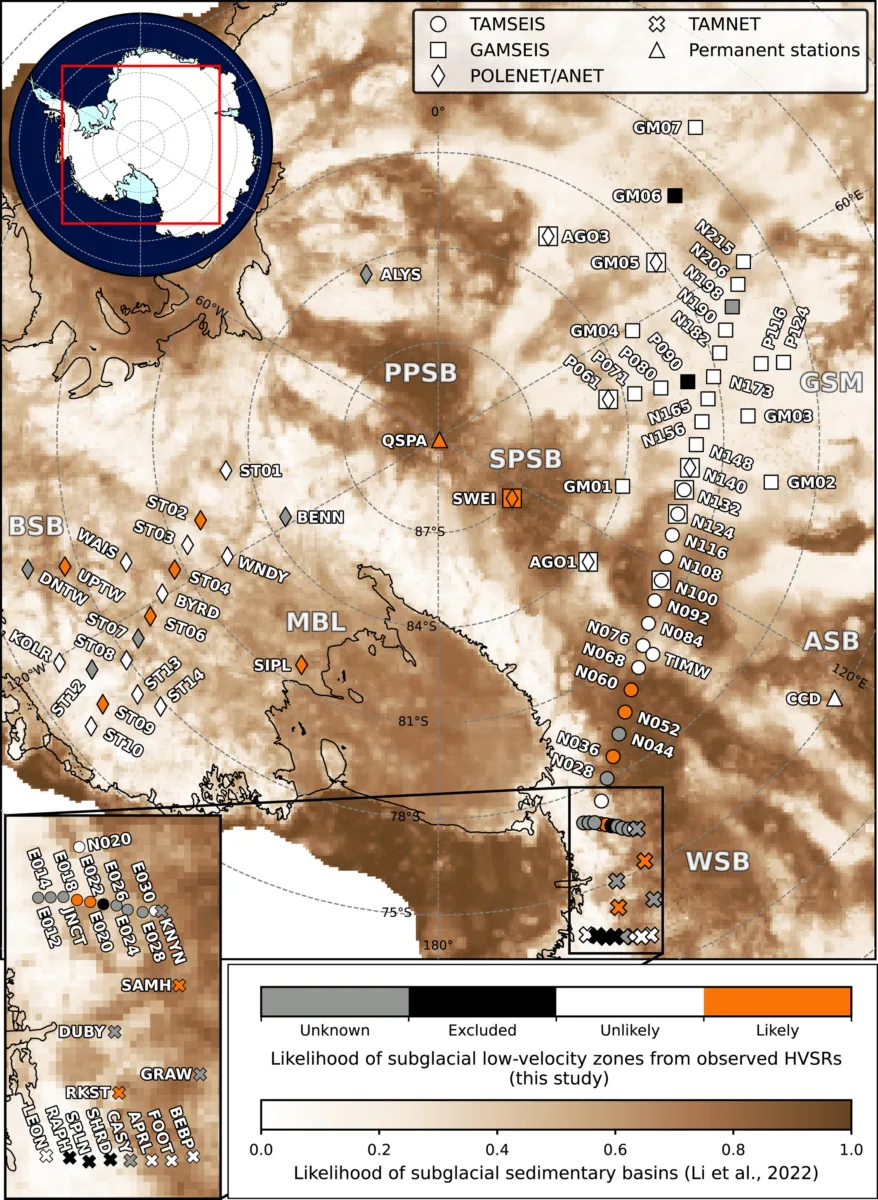
This new seismic analysis didn’t always line up with the previous map: some locations the researchers deemed “unlikely” to have an interface zone sat overtop accepted sedimentary basins (and vice versa). This conflict could indicate that the subsurface in these areas is particularly complex — or point to gaps in the new strategy.
This oceanic “background noise” method is very sensitive to subglacial topography: it works best when the subsurface is relatively flat, while steep relief can muddy the results and make it hard to see evidence of interface zones. The accuracy of this approach also depends on correctly measuring the thickness of the ice underlying the seismometers. This method will be most useful when combined with other geophysical techniques that can work together to give a clearer, more comprehensive picture of Antarctica’s subsurface “sliding zones.”
A crucial contributor?
As our climate warms, accurate mapmaking of Earth’s vulnerable ice-covered regions will become increasingly critical. Global sea levels are rising at an accelerating rate, and each year, an average of 150 billion metric tons of ice is lost from the Antarctic Ice Sheet.
Rising seas present real danger: in 2000, an estimated ten percent of the global population lived in coastal lowlands directly threatened by sea level rise. This number is only getting larger: coastal populations grew by an estimated 26.6% between 2000 and 2018, with the fastest growth occurring in areas nearest to the shoreline and therefore most at risk.
To prepare for these hazards, we need to understand their major contributors. Predicting the future of the Antarctic Ice Sheet requires extremely detailed models of how it moves — and oceanic “background noise” could actually be at the forefront of this effort.
This study utilized seismic data from the NSF NGF data archive, including permanent networks and temporary experiments supported by the NSF NGF.