

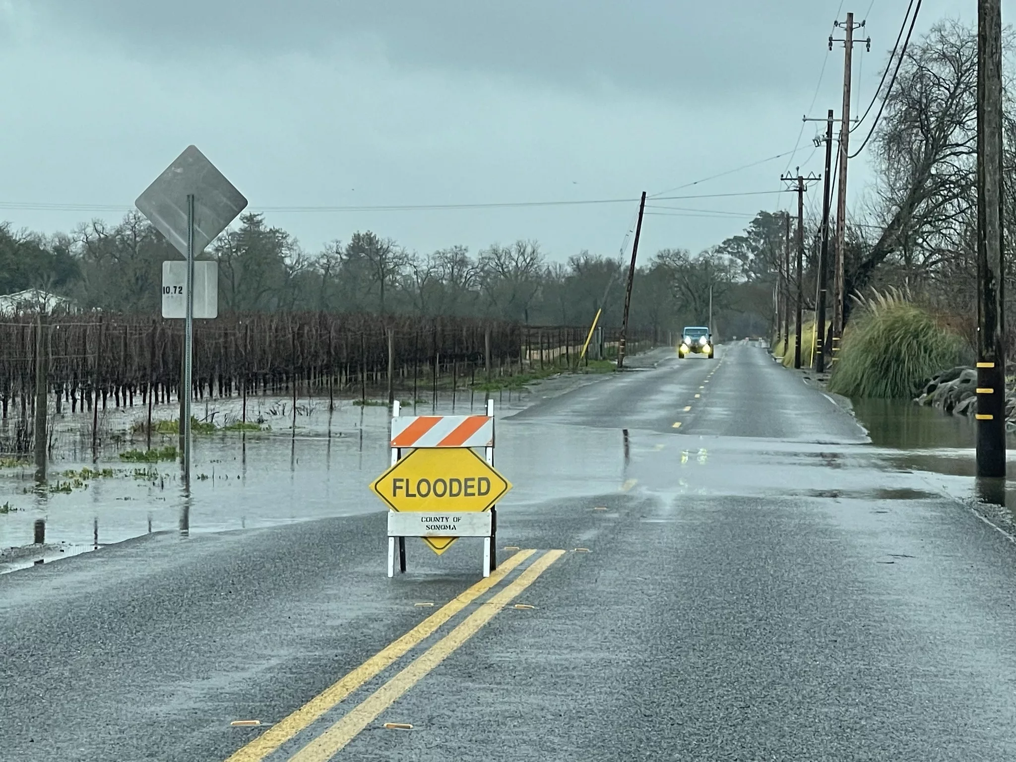
In early 2023, an incredible amount of precipitation fell on drought-stricken California thanks to a seemingly endless convoy of atmospheric rivers. The surface effects were quite visible―ranging from green vegetation to landslides―but it’s not quite so easy to track how this affected groundwater.
Monitoring wells provide good measurements of water levels but are expensive and fairly sparse. Geophysics lends a hand to this problem with a number of techniques that can estimate water storage over broad areas, like the GRACE-FO satellite mission that measures mass change or GPS stations tracking land surface elevation. A recent paper in Science led by Stanford’s Shujuan Mao shows off a newer addition to that toolkit―seismometers.
Seismic data contains information about two things: the source of seismic waves, and the material those seismic waves have traveled through to reach the seismometer. In this case, the source is constant background noise caused by things like wind, waves on the coast, or road traffic. The material that vibration travels through happens to include groundwater aquifers, and water alters the velocity it travels at. That means that rising or decreasing groundwater levels affect the seismic data.
Comparing the timing of this noise at different seismometers shows a consistent delay related to their distance from the source. When groundwater levels change, that delay shifts. Even better, different frequencies of vibration travel through different depths―so the shifting delay at multiple frequencies can tell us about groundwater aquifer layers at a range of depths.
For this study, 68 seismometers around the Los Angeles area―part of the Southern California Seismic Network―were used to generate maps of groundwater change in this way.
The team compared their results to other established datasets, including wells and records based on GRACE-FO or GPS data. These fit together well, keeping in mind that each is measuring something slightly different―GRACE-FO and GPS, for example, are sensitive to surface water as well as groundwater.
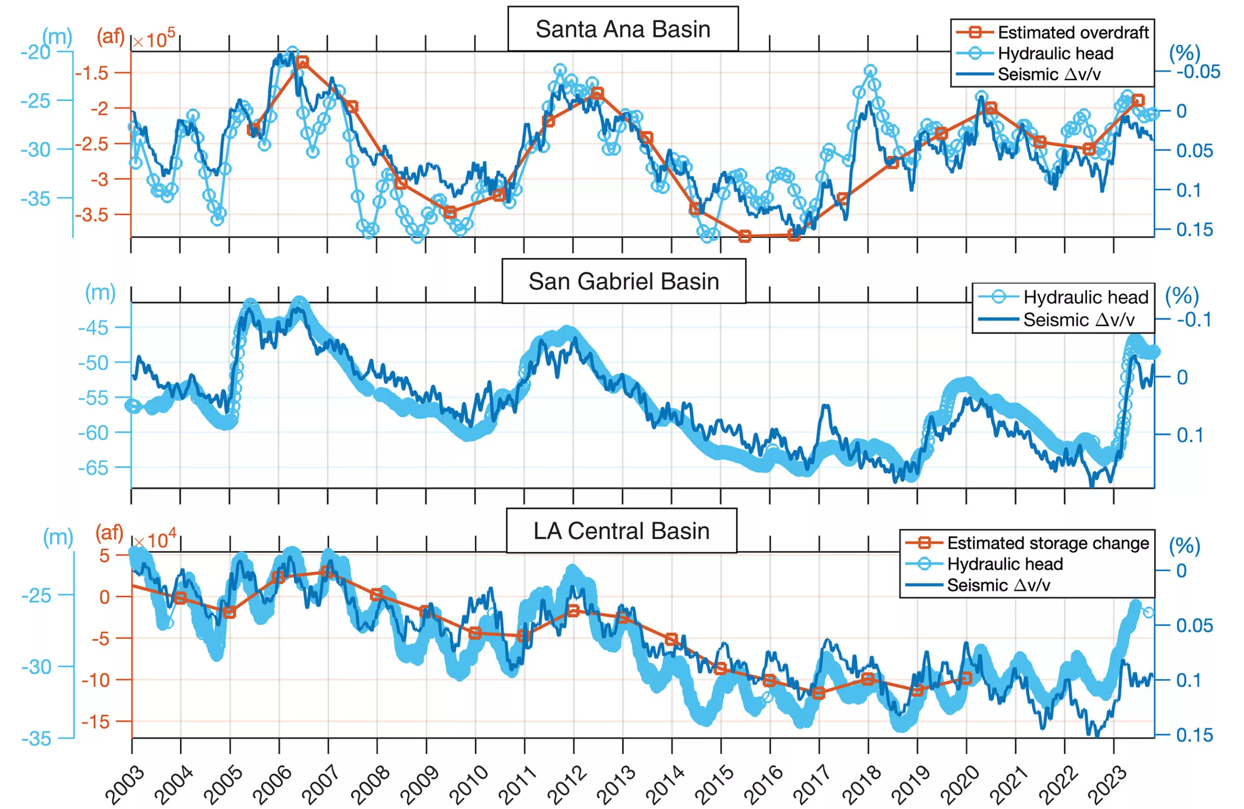
Their seismic dataset is much higher resolution than something like GRACE-FO―for which LA is only part of a single grid cell that extends into Mexico―showing changes at a level of detail closer to InSAR satellite measurements of surface elevation displacement.
The most unique aspect of the seismic dataset is its ability to assess groundwater at different depths. Unsurprisingly, this shows shallow groundwater―which is better connected to surface inputs―responding more quickly to the extreme early 2023 precipitation, with muted increases of deeper groundwater occurring later. Hurricane Hillary later in 2023, for example, caused a notable spike in shallow groundwater but no response farther down.
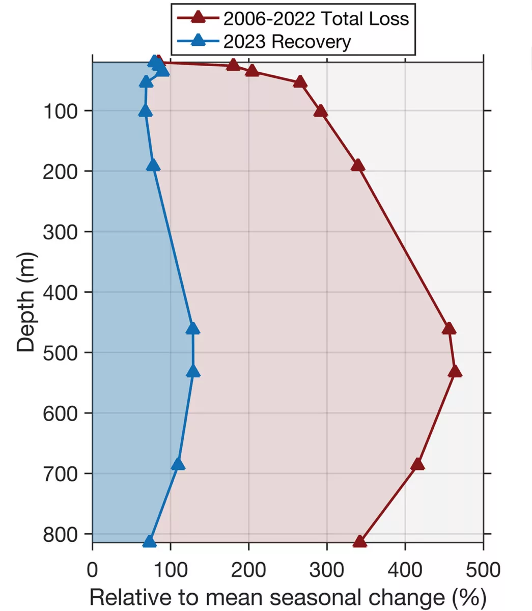
Over the longer term, this shows up in differing trends with depth. While the shallow aquifer has largely wiggled around its average with varying weather conditions, deeper aquifers show a continuing trend of depletion over time. By the end of 2023, shallow groundwater had pretty much recovered to 2006 levels thanks to all the precipitation. But the deeper aquifers had only recovered about 25% of the water that had been lost since 2006.
Each of these geophysical tools contributes something unique that can be combined to give us an accurate understanding of changing groundwater resources. In areas where we have dense networks of seismic instruments, that particular tool could be a great help in revealing what’s going on beneath the surface.