Every year during the Antarctic summer field season, EarthScope engineers are busy supporting work at Mt. Erebus, in the Dry Valleys, and out on the ice. One recent project is a bit different than the others, in that it’s related to the preservation of human history in Antarctica—specifically, supporting the New Zealand Antarctic Heritage Trust’s work at Discovery Hut, just a short walk from McMurdo Station.
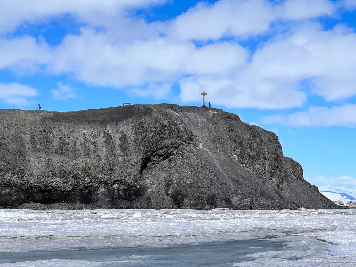
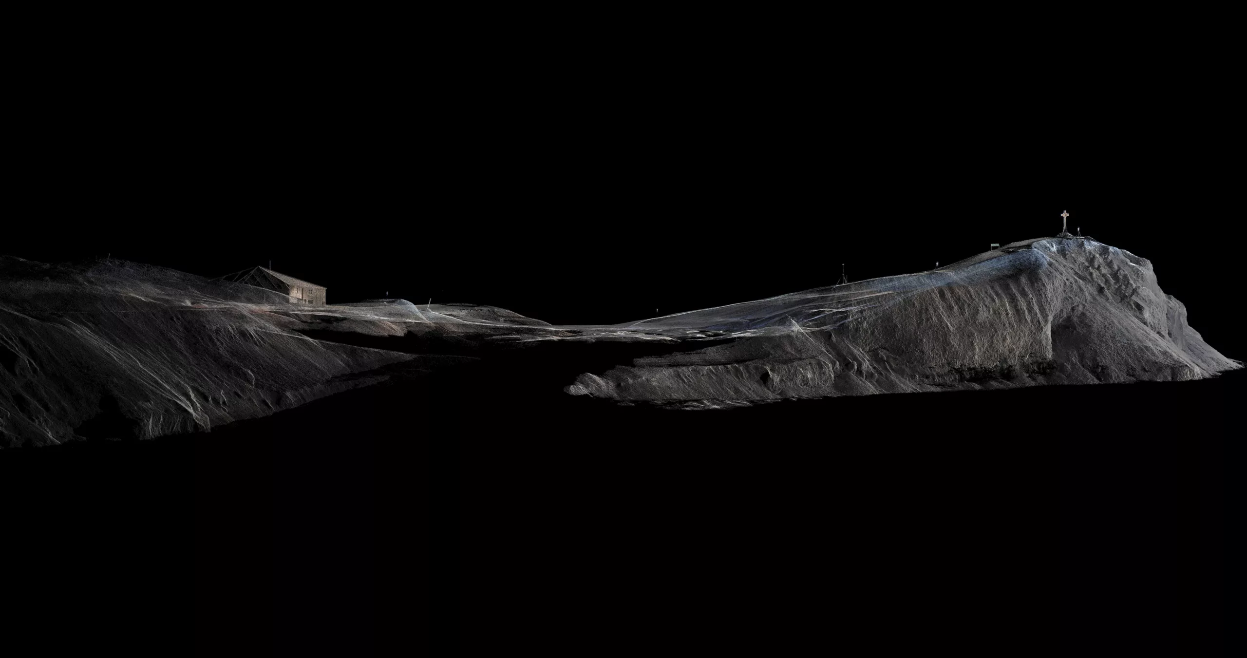
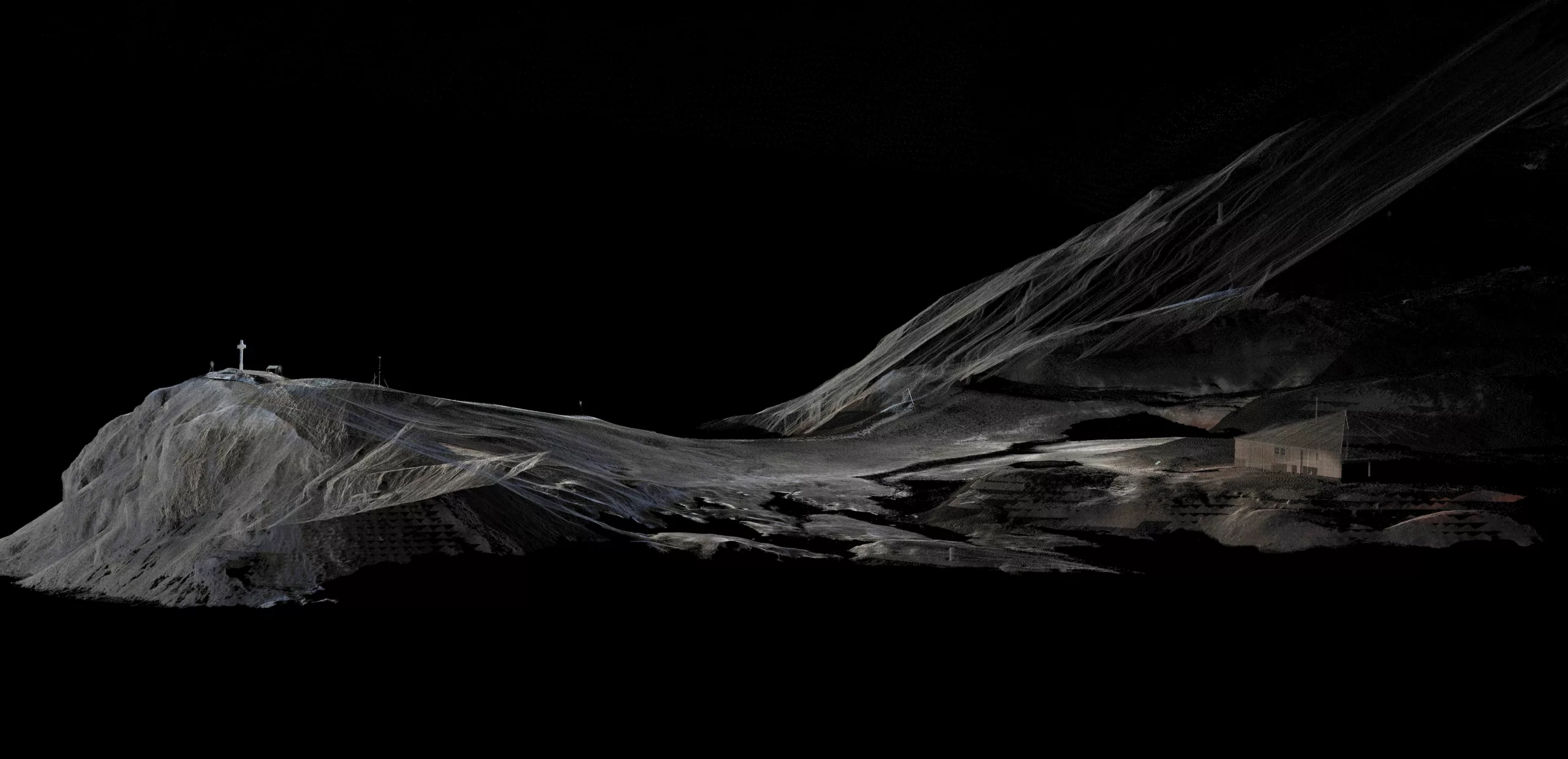
Discovery Hut is a well preserved, wood building that was erected as a base for Robert Falcon Scott’s 1901-1904 Discovery Expedition. In addition to the hut itself, there is a small cross on the neighboring hill—a memorial for a member of the expedition who died.
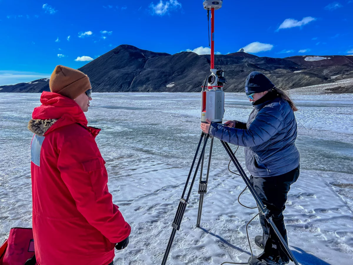
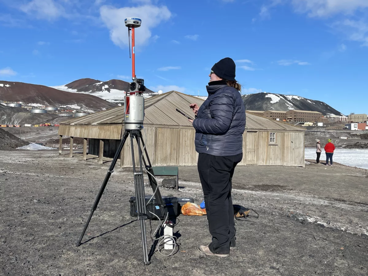
The New Zealand Antarctic Heritage Trust conserves this culturally significant site, and has teamed up with EarthScope (and previously UNAVCO) in recent years on data collection projects in service of that work. A 2010 project, for example, applied terrestrial laser scanning to generating precise 3D models of the interior and exterior of the hut. And over the past few years, repeated laser scans are being used to map the shoreline of Hut Point, where this site stands.
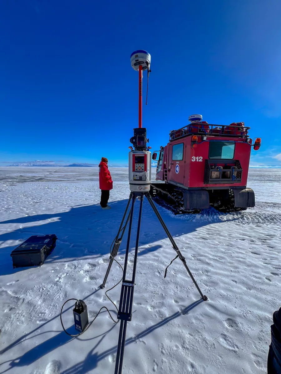
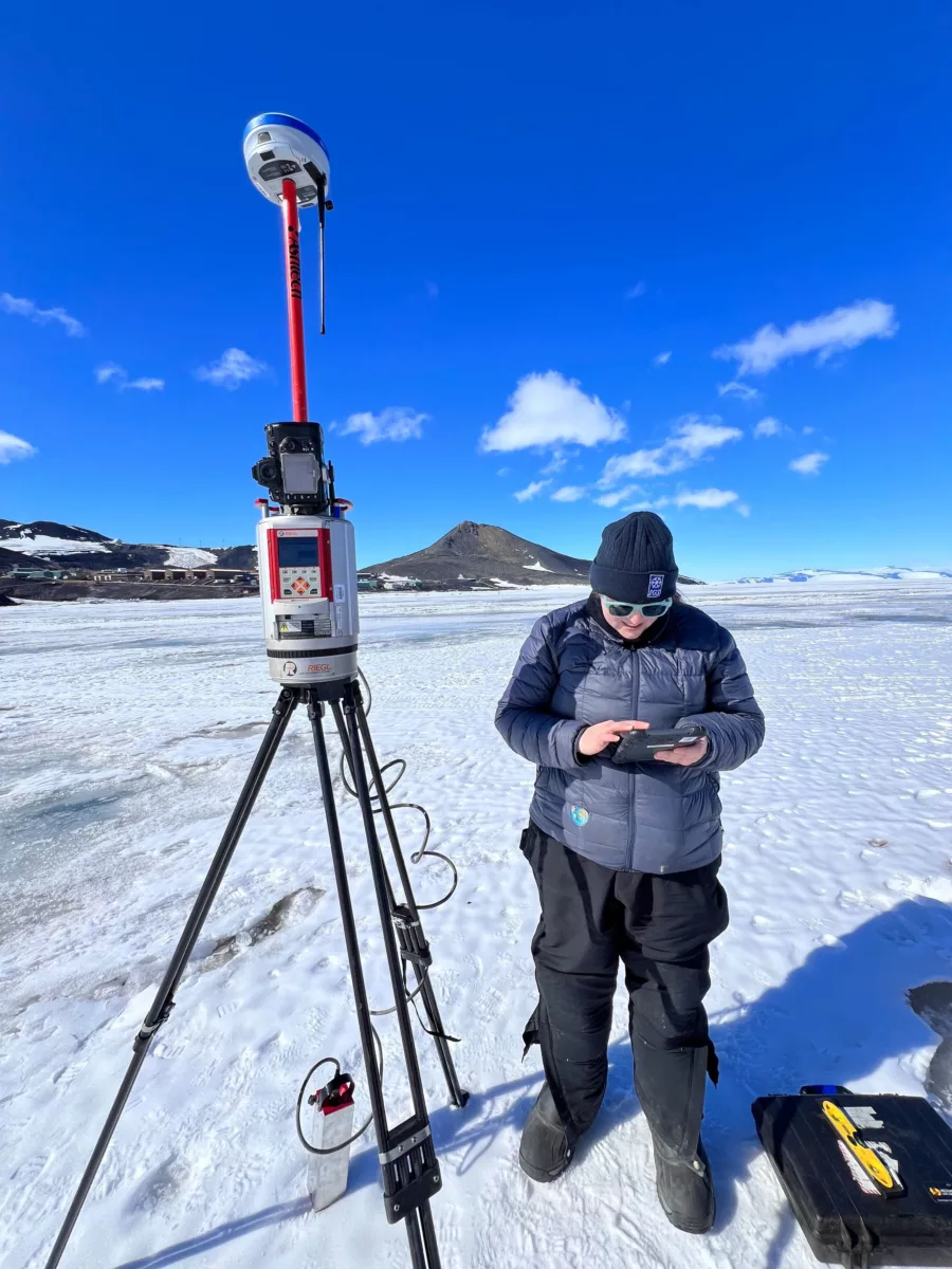
These tripod-based terrestrial laser scanning instruments use lidar to precisely measure the positions of surface features on the landscape in great detail. By repeating these scans over time, we can measure how the peninsula’s morphology is changing. The New Zealand Heritage Trust’s goal for this project is to estimate the current shoreline erosion rate in the context of climate change.
The scans are performed from locations on the sea ice, looking back at the shoreline, and so have to be done early in the Antarctic field season before the sea ice has a chance to melt and become dangerous. That means a good deal of training beforehand and assistance from McMurdo field safety staff to navigate across cracks in the ice.
It can also mean uncontrolled delays to give a wide berth to curious wildlife—like one particularly inconsiderate seal that once parked itself near the instrument for an extended period.
Scans from multiple vantage points get combined into a single model through the use of highly reflective markers with precisely measured positions. Those bright, consistent points enable multiple models to be carefully aligned with each other. And because the position of everything in the model is recorded so precisely, models from different years can be compared to detect even small changes caused by shoreline erosion.
And that information is what the New Zealand Antarctic Heritage Trust needs to plan ahead and make effective decisions for preserving this piece of history.