Terrestrial Laser Scanning (TLS) is a useful way to get a highly accurate 3D model of a small-scale topographic feature, and is an available imaging technology to create photorealistic digital images. The geodetic applications of TLS make it an incredibly useful technology for many Earth science fields.
How TLS works
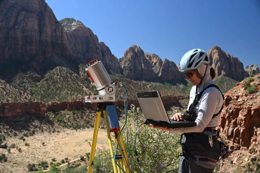
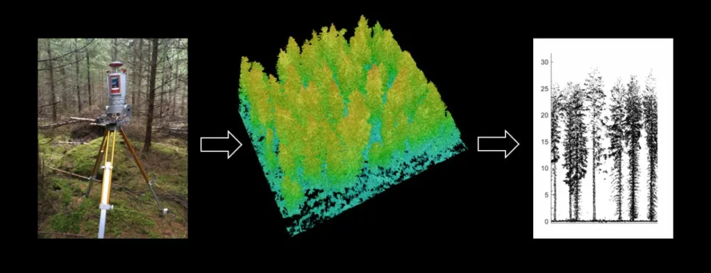
TLS uses a lidar (Light Detection and Ranging) device on a tripod to scan an area around it. It sends out light pulses that bounce off a surface and travel back towards the transmitter. Based on the time it took the light to return, it can calculate the position of that point in three dimensional space. By sending out up to hundreds of thousands of light pulses per second, it is able to determine and store a bunch of discrete data points representing surfaces. This set of points is called a point cloud, and is a digital representation of the space being visualized and scanned. By integrating a traditional digital camera, photo-accurate colors can be added to the points in your rendered model.
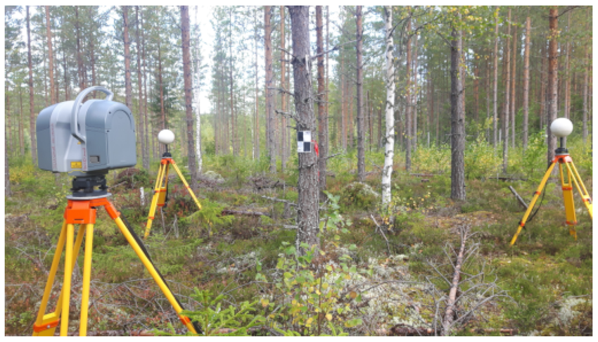
Because the transmitter is only sending out light pulses, these can’t travel through objects to see its shape or surfaces on the other side. To image from multiple angles or cover a larger area,, researchers can place markers with GPS-measured positions down before the first scan. They are then left in place while multiple scans are run from different positions. These markers are points that can then be used to match up all the different angles of scans and create one comprehensive digital model of the environment.
Why use TLS?
TLS concentrates on smaller spatial extents of the landscape—from tens of centimeters to a couple of kilometers—to get highly accurate 3D models of the surfaces for static measurements and measurements of change over time.
This process may seem similar to InSAR, but has its own distinct applications. As a satellite-based technique, InSAR works over far larger scales, but at lower resolution and from an overhead angle. Conversely, over a small area where resolution is key, TLS can provide extremely high spatial resolution on the scale of millimeters. This makes it more suitable for detailed and localized mapping of smaller scale features, particularly where the three-dimensional geometry is important.
TLS also allows for more real-time measurements. If you did want to compare surfaces over a long period of time, InSAR could be a better option since satellites make repeat measurements that span years. But while InSAR data for a given location is only available around once a week when the satellite’s orbit passes overhead, a TLS scan of a single scene can be completed in just minutes and repeated at any time. When frequent measurements are needed, TLS can provide a very quick and extremely detailed model.
Many people equate TLS and lidar in everyday language, but TLS is a form of lidar, just a different form of it. Lidar can be on the ground in the form of TLS or aerial on an Uncrewed Aerial System (UAS). Depending on the application and you are trying to measure and model, the location of the instrument performing lidar will vary.
Applications
In the case of TLS, the applications are new and emerging but have a wide range. Using the imaging technique of multiple scans with common targets allows for more accurate imaging and measurement of surface changes over time. By comparing images from multiple times, you can see an entire area change from events like erosion, landslides, volcanic deformation, and fault slip. You can see not only how the surface was affected, but the environment around it.
NSF GAGE provides TLS support for research groups looking to use it for geodetic imaging. In 2014, that included a research group looking to find the weight of seals without having to disturb them and put them on physical scales. Lidar data from the TLS was able to help produce mass estimates of the seals in order to understand their physiological relationships before weaning (when seal pups are able to leave their mothers and forage on their own).
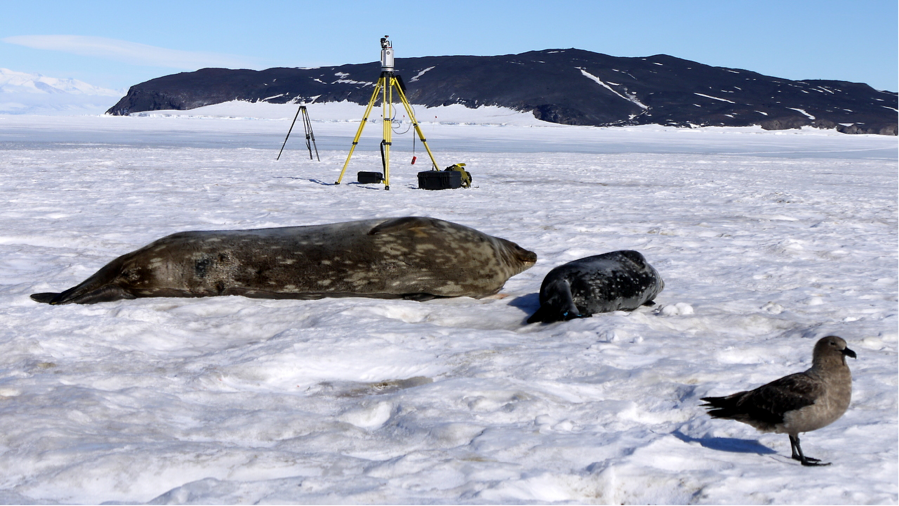
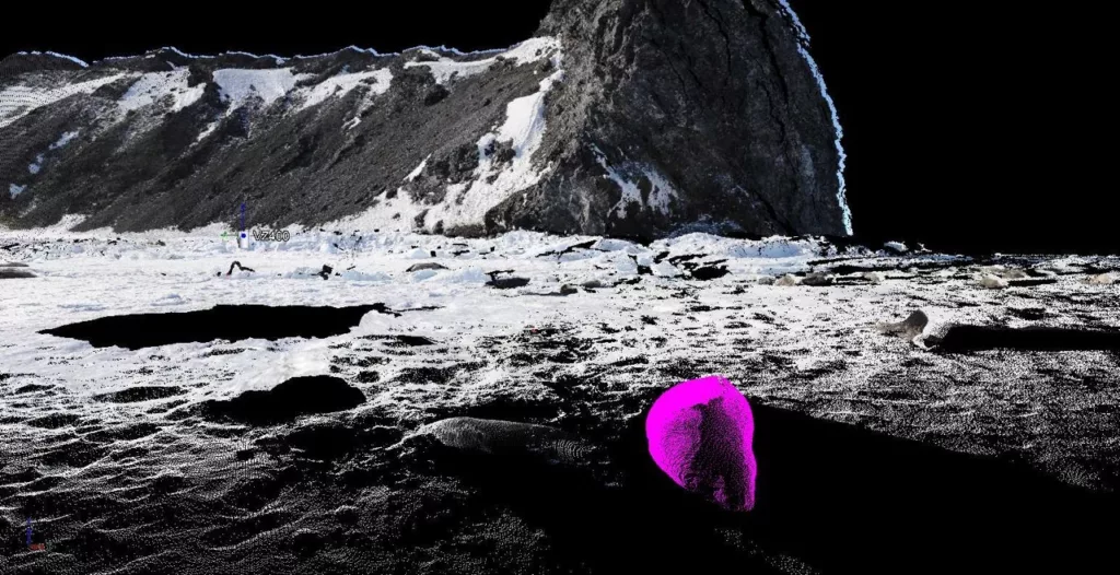
(Photo: Brendan Hodge/EarthScope)
Another project in 2022 used TLS to study two rockfall hazards in Zion National Park. In one location, an unstable block was scanned from multiple sides to calculate its size and center of mass. In another, measurements of a large cliff over the course of 24 hours were used to measure how much the rock face moves as it warms and cools.
TLS is even employed in archaeology and historical preservation efforts in order to precisely document the position and shape of objects. The Discovery Hut in Antarctica—left from a 1901-1904 expedition—has had its interior scanned as part of preservation work there. Additionally, TLS has been used to study shoreline erosion nearby.

