


The EarthScope-operated data systems of the NSF National Geophysical Facility are migrating to cloud services. To learn more about this effort and find resources, visit earthscope.org/data/cloud
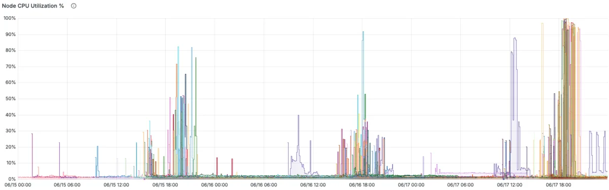
Less than a month after we opened GeoLab to all users, the platform supported 98 participants in a three-day virtual technical short course hosted by the Cascadia Region Earthquake Science Center (CRESCENT). Held June 15 – 17, 2026, the course, “Strain Accumulation and Release from GNSS,” introduced participants to how earthquake-cycle signals in the Cascadia Subduction Zone appear in geodetic observations, from raw GNSS time series to models of fault slip.
The course was taught by Jack Loveless of Smith College, Brendan Crowell of Ohio State University, Kaj Johnson of Indiana University Bloomington, and Tim Melbourne of Central Washington University. All four instructors are members of CRESCENT’s Coupling, Seismicity, and Slow Slip working group.
GeoLab as the course platform
GeoLab, a browser-based JupyterHub environment, provides a uniform compute environment with the required libraries already installed, allowing participants to start working right away instead of setting up Python, installing packages on their own machines, and troubleshooting dependency conflicts or other individual configuration challenges.
During the course, participants opened the same prepared notebooks as the instructors from the CRESCENT GitHub repository and worked on them live within GeoLab, running code, adjusting parameters, and checking their results as each session progressed. With Git natively available in GeoLab, participants could pull instructors’ notebook updates as they were made and continue from the same point, rather than copying files manually. CRESCENT has since released the lecture slides and notebooks on the course page for researchers who want to run the workflow.
GeoLab’s strengths were most evident in the later sessions, when the course shifted to fault-slip inversions and viscoelastic modeling. GeoLab handled these computationally demanding calculations in the cloud with dynamic scaling, allowing participants to estimate slip, compare model results, and follow along in the browser without needing specialized local computing setups.
Since the course notebooks are publicly available and run seamlessly in GeoLab, participants and researchers can clone the GitHub repository in their own GeoLab workspace and continue exploring the workflows in the same cloud-based environment used during the live course.
From time series to fault slip
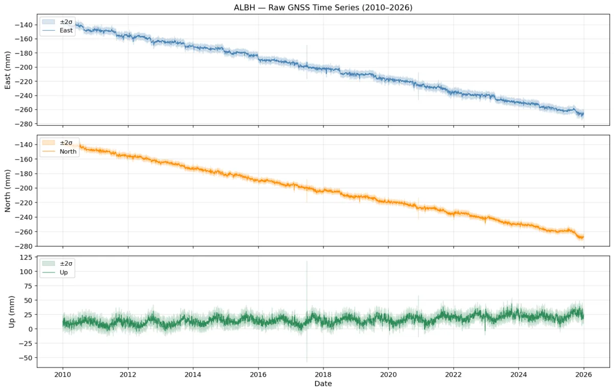
Aimed at graduate students, postdocs, and professionals working in geodesy and tectonics, the three days built on one another. Participants started with GNSS position time series and identified the signals that track the earthquake cycle, from steady interseismic motion to sudden coseismic offsets and slow-slip transients. They then used those measured displacements and velocities to estimate fault slip and the degree to which the plate interface is coupled. The course concluded with viscoelastic earthquake-cycle modeling, which showed how the slow response of the solid Earth influences the surface deformation recorded by geodetic instruments.
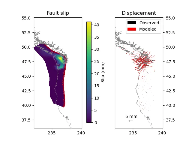
These methods help researchers better understand where strain is accumulating along subduction zones, improving the scientific basis for studying earthquake hazards in regions such as Cascadia. Participants who attended at least 80% of the course earned a digital microcredential badge issued by the NSF National Geophysical Facility through Credly.
For more information on courses we support, visit the Courses page of our website.