

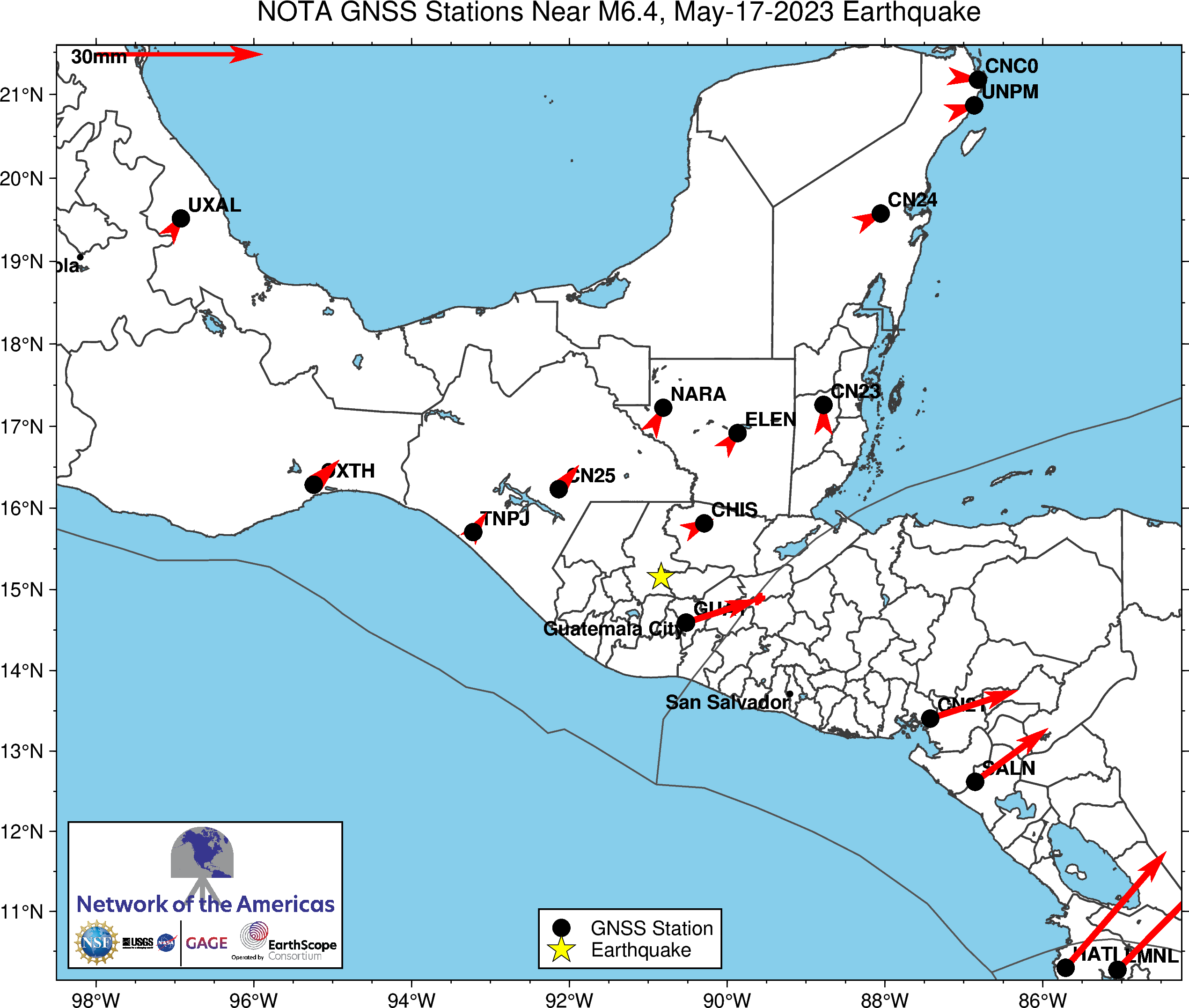
These vectors (see 30 mm/yr scale at top left) show the long-term average tectonic motion captured by GPS stations in the region.
M 6.4 Guatemala
Location: ...°, ...°
Depth: ... km
These data are provided by the GAGE and SAGE Facilities, operated by EarthScope Consortium with support from the National Science Foundation and the National Aeronautics and Space Administration under NSF Cooperative Agreements EAR-1724794 and EAR-1851048. To acknowledge use of these data please follow the acknowledgment guidelines.
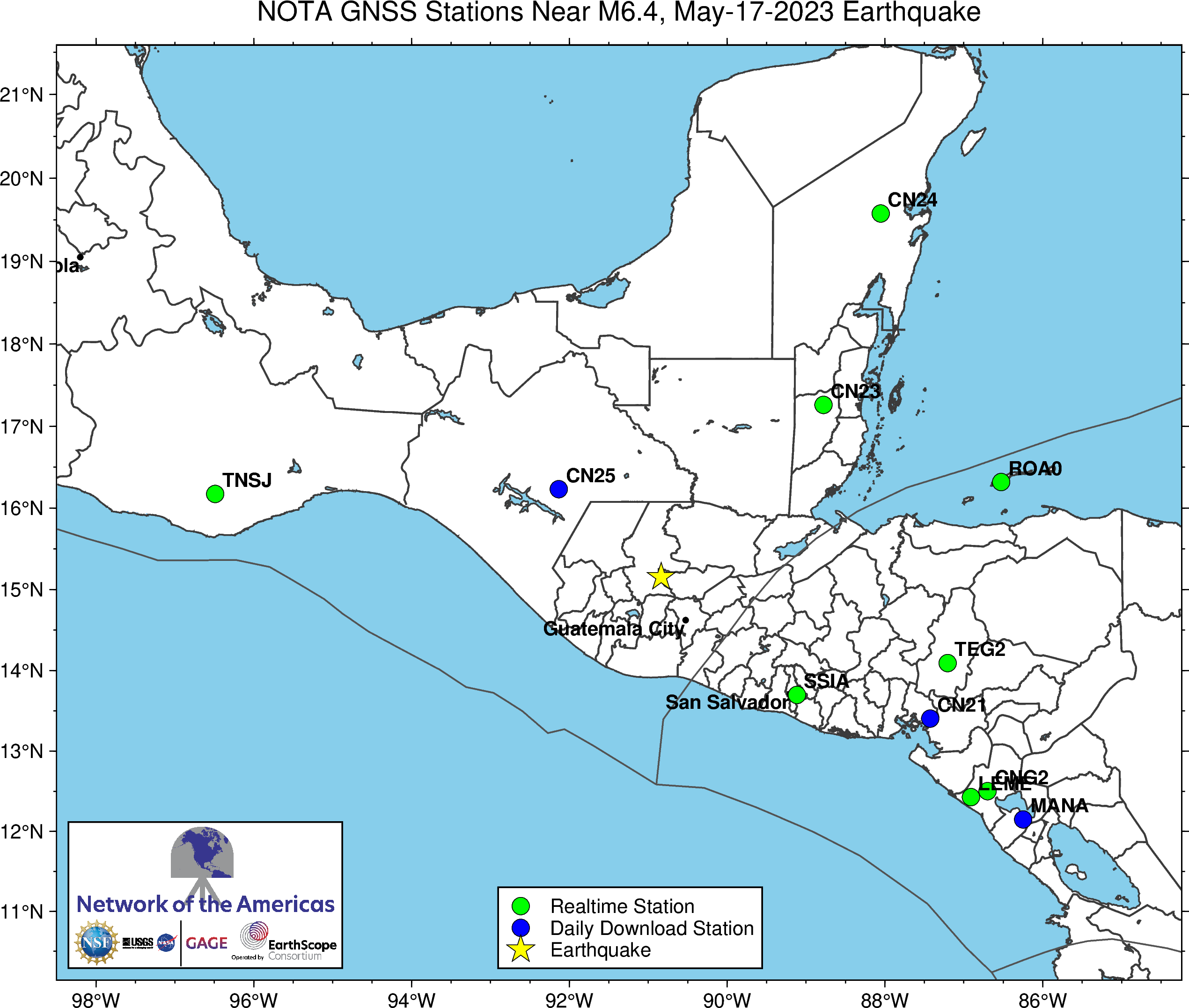
The event occurred within the footprint of the Network of the Americas (NOTA), a network of continuous GPS/GNSS stations and borehole instruments operated by EarthScope Consortium that monitors plate motion and transient deformation, in addition to other applications. Stations near the event for which EarthScope delivers data include collaborations with Instituto Geográfico y del Catastro Nacional, El Salvador (SSIA), the Ministry of Natural Resources, Belize (CN23), and UNAM (CN24, CN25). Use of data from all stations should be acknowledged appropriately.