


Electricity naturally seeks the easiest path to flow. Some materials, like metal and groundwater, allow electrical currents to move through them easily, while others, such as dry rock or rubber, are more resistant to the flow of electricity.
Geophysicists take advantage of these differences using a technique called electrical resistivity tomography or ERT to create images of what lies beneath our feet.
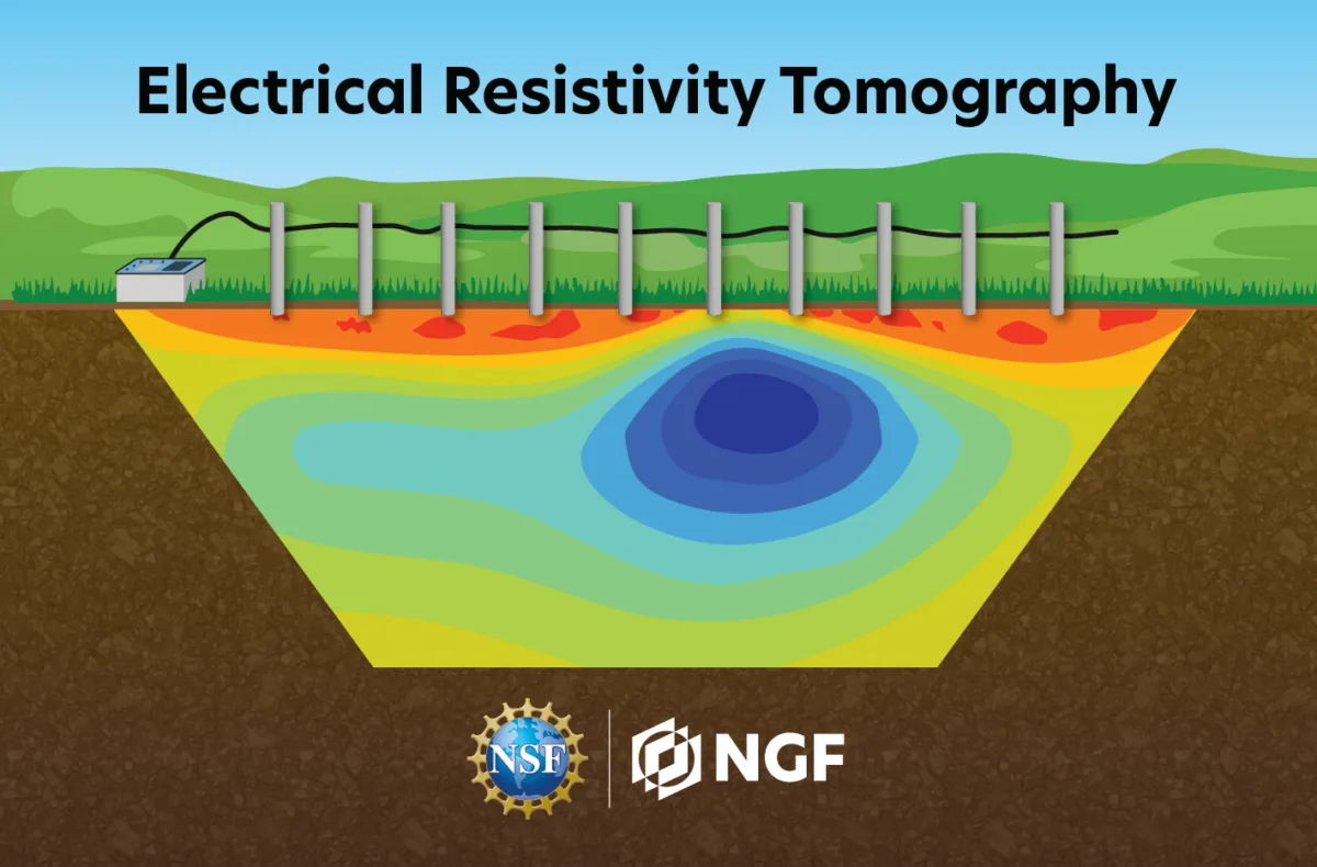
How It Works
Materials with high conductivity (ability to transport electricity) have low resistivity (resistance to the flow of electrical currents). Geophysicists measure the resistivity of soil and the rock below the earth’s surface to help determine what is below our feet, without disturbing the ground by digging.
An ERT survey drives low-voltage electrical currents through the ground to measure how strongly different parts of the subsurface resist that current. Layers of soil, bedrock, groundwater, caves, archaeological features, and even permafrost each have distinct electrical resistivities. For example, water has low electrical resistivity while solid dry rock has a high resistivity.
If you were hired to drill a well to supply water to a small town, how would you determine the best place to drill to reach a groundwater layer? Beneath the surface of the earth, some rock units are intact, while others are riddled with cracks of fractures, and these fractures can be filled with water. Electrical current flows more easily through the water-filled fractures than through the rock. The more water-filled fracture zones a rock has, the lower the resistivity of that zone. Therefore, the best place to drill into rock would be in a zone with lots of fractures so that a pump can easily draw water up.
What if you were hired to help a team of archeologists find a potential excavation site? When digging for fragile artifacts or structures, it can be especially important to know what lies beneath the surface before your shovel hits the ground. With ERT, underground structures composed of stone or brick would be detected as zones of high resistivity since they contain less moisture than the earth surrounding them. Meanwhile, organic materials such as clay or wooden materials would show up as low resistivity zones. This helps archeologists delineate features before starting an excavation.
What You Need
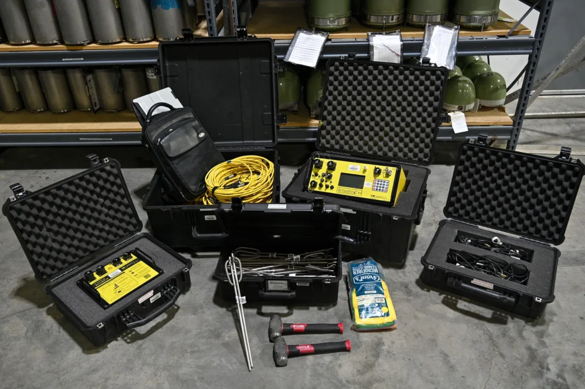
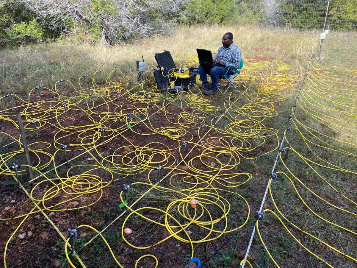
Every ERT survey requires a resistivity meter, connecting cables, and at least four metal stakes pushed into the ground called electrodes. During each measurement, two electrodes are used to deliver an electrical current, while the other two are used for taking a reading of the electrical potential (the difference in their voltage). Together, these measurements provide the apparent resistivity of the subsurface, which is the field measurement of resistance influenced by all the materials the current passes through.
However, each measurement is only one piece of the puzzle. By repeating this process hundreds or even thousands of times with different combinations of electrodes, a computer software will then combine them using a mathematical process called an inversion to create an image of the subsurface using its true resistivity, which reflects the actual physical resistivity of a material.
The spacing of the electrodes also affects what the survey can detect. Electrodes placed close together produce detailed images of shallow features, while wider spacing allows the electrical current to penetrate deeper into the ground, revealing larger structures at greater depths. Geophysicists choose the electrode spacing and survey length based on the size and depth of the features they want to investigate.
What You Get
The final result is a resistivity profile showing areas underground with higher and lower resistivities.
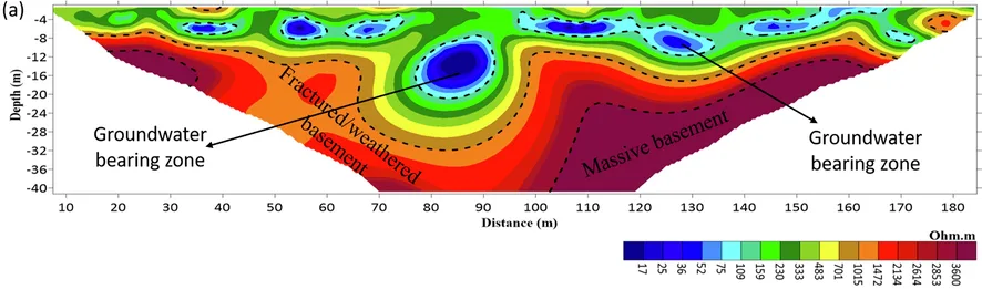
The figure above shows a profile where each color tells us something about what lies under the surface. In this profile, the blue regions represent low resistivity, which point to groundwater-bearing layers hidden below the ground. Deeper in the profile, the colors shift to red, revealing areas with higher resistivity. These zones are interpreted as weathered basement rock, while the darkest red areas represent solid basement rock, where electricity does not flow as easily.
By interpreting resistivity patterns, geophysicists can infer hidden features for a wide range of purposes from engineering, environmental geophysics, to even crime scene investigations. Instead of relying on drilling or excavation, this geophysical method provides a non-invasive means of investigating the subsurface, and can be used for locating and estimating the depth of aquifers for drinking water, mapping underground caves or sinkholes that could pose hazards, assessing the influence and trees on ground water, detecting contaminants from landfills, mapping bedrock depth before construction, locating hidden structures, and more. These underground maps help answer important questions in not only science, but also society.
Part of the geophysical toolkit
ERT is a powerful non-invasive means of exploring the subsurface. This begs the question: how does it compare to other non-invasive geophysical methods, such as ground penetrating radar (GPR) or seismic refraction? Studies have shown ERT to be very useful in highly conductive layers, when the propagation of GPR signals is limited. It is also advantageous for investigating extreme depths (up to hundreds of meters), while GPR typically measures 1-30 meters depth. However, ERT has a lower spatial resolution than GPR.
The geophysical method best suited for your task will depend on the goal of your investigation and pairing methods is often the most powerful approach!