At subduction zone plate boundaries, a number of processes contribute to the creation of towering mountain ranges. Volcanic activity is partly responsible, both because erupted rock builds up and because the arrival of deep magma can “inflate” and lift the surface above—but the relative contributions of the two are difficult to work out.
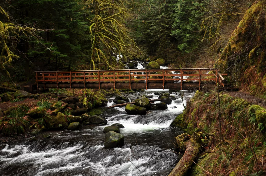
In a recent study published in Science Advances, a team led by Nathaniel Klema finds a natural laboratory in the Columbia River Gorge. For at least 17 million years, the Columbia River has sawed its way to the sea as a mountain range grew up around it. There is history to be read in the walls of the gorge, including history of the mountains’ rise and the river’s erosive power.
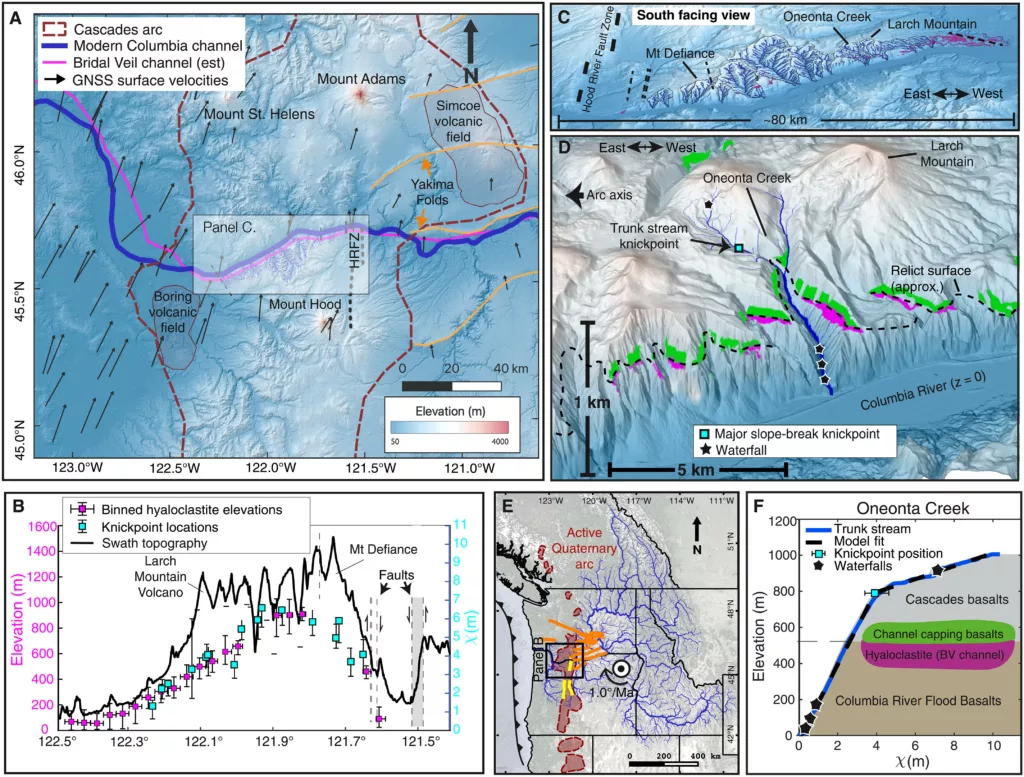
Following a layer of 3-3.5 million-year-old volcanic rock through the gorge, for example, reveals that it has been deformed since it was deposited in the old river valley. It arches upward almost 900 meters toward the center of the Cascades. So what deformed it? You might guess tectonic forces, with the continental crust crumpled against the subduction zone plate boundary with the Pacific plate, squeezing this upward. But GPS stations record a more complex clockwise rotation of this area, with the Columbia River sitting at the transition between compression to the north and extension to the south.

The researchers hypothesize that this arching deformation is instead mostly the result of magma inflating the region from below. And the unique setting of the Columbia River Gorge makes this an opportunity to estimate the relative contribution of magmatic inflation and erupted rock in creating topography.
Running the numbers
It would be hard to accept this explanation if there weren’t magma beneath this area, so the researchers first review multiple types of geophysical data. That includes gravity data, heat flow measurements, and seismic imaging. They all highlight an anomaly consistent with the presence of deep magma.
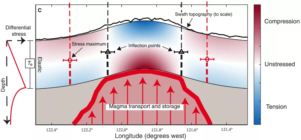
Next, the team modeled how the crust would bulge in response to uplift due to inflation. Since the crust has some rigidity to it, it will flex over a distance—more like bending a ruler than poking a sponge. Based on the properties of the crust in this area, they estimate a plausible uplift force in the center of the geophysical anomaly that would be able to produce the observed arching along the river.
With this done, it’s possible to compare the amount of mountain building caused by magmatic inflation to the volume of that arching layer of volcanic rock. This puts the effect of inflation at about three times greater than the effect of the eruptions.
But for a separate estimate, the researchers instead examined the slopes of tributary streams flowing into the river within the gorge. Because stream erosion is stronger when a steeper run increases the velocity of the water, the shape of a stream channel contains a record of land uplift. If uplift is constant, the stream erodes downward at a constant rate. But if uplift speeds up, stream erosion will increase to maintain equilibrium—leaving behind a step change in the slope of the channel.
Examining this pattern in high-resolution topography data for 16 tributary streams, they calculate the mountain-building effect of inflation to be at least 1.4 times the effect of the eruptions.
An organizing influence
So if the influx of magma deep below the surface has left a significant mark on the surface topography here, what else might that help explain? The researchers point to some other features on the landscape they think could be related.

The crust flexing around an uplifting force produces areas of tension (think of skin stretching along your elbow as it bends) and compression (like the inside of that elbow). Some faults around the Columbia River align with that pattern. And areas of volcanic eruptions, including peaks like Mt. Hood, are offset some distance from the center line of the signs of deep magma rather than right above it—upward-migrating magma could be directed that way as it navigates the compression and tension. The erosion of the Columbia River Gorge itself could even play a role in the Boring and Simcoe volcanic fields located near either end, as the removal of all that rock modifies the pattern of stress in the crust.
“Our work suggests that intrusive magmatism has a broad organizing influence spanning surface topographic development, crustal stress state, and magma ascent pathways,” the researchers write. A combination of geophysical tools can often paint in a more complete picture than a single dataset provides, allowing hypotheses to be tested from multiple angles. And in this case, the result might be an answer to an interesting question about a grand landscape.
Seismic and some GPS data used in this research accessed via NSF’s SAGE and GAGE Facility archives, which are operated by EarthScope Consortium.

