

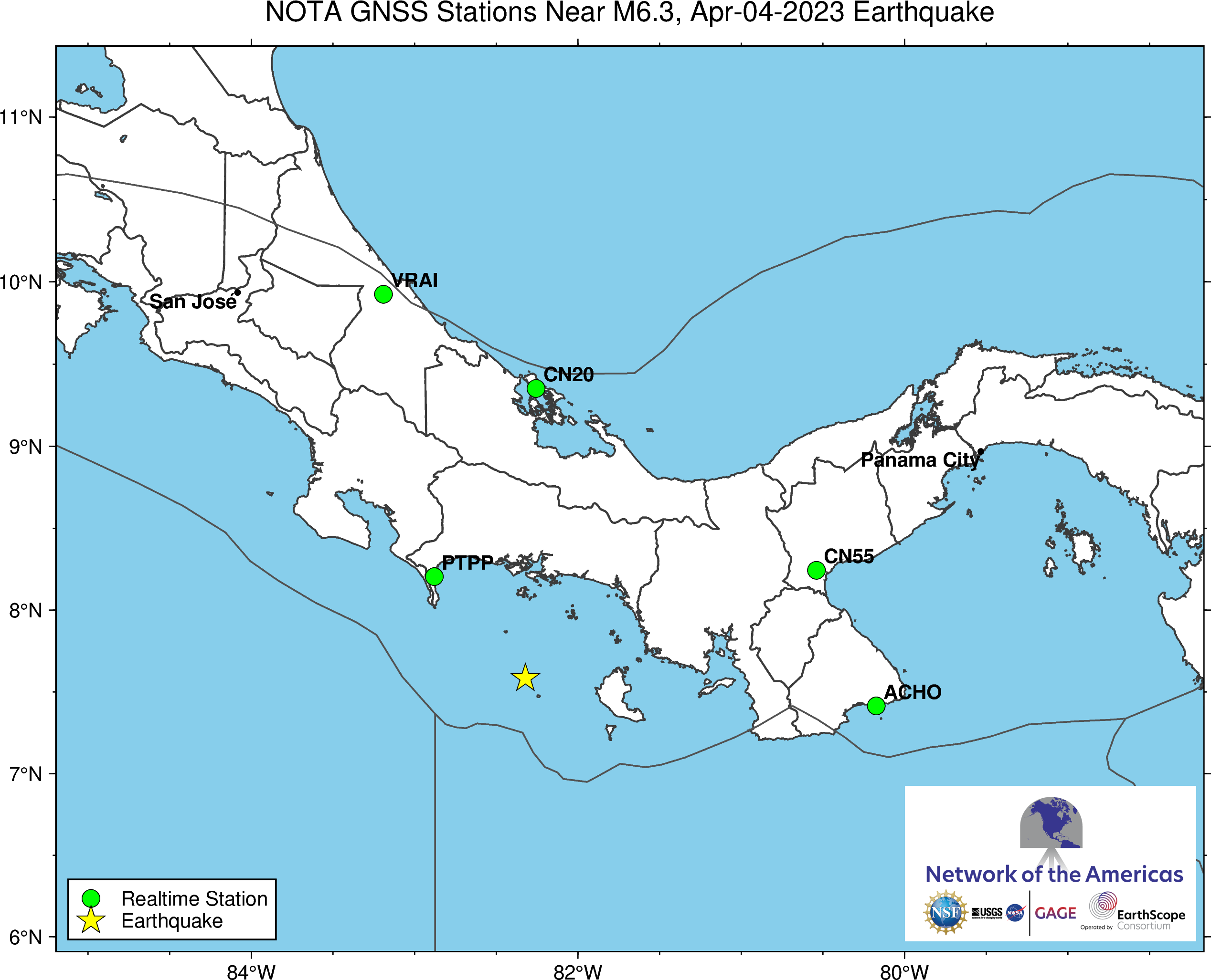
This map shows stations within the radius of predicted 1 cm displacement. Station PTPP was offline at the time of the earthquake.
M 6.3 Boca Chica, Panama
Location: ...°, ...°
Depth: ... km
These data are provided by the GAGE and SAGE Facilities, operated by EarthScope Consortium with support from the National Science Foundation and the National Aeronautics and Space Administration under NSF Cooperative Agreements EAR-1724794 and EAR-1851048. To acknowledge use of these data please follow the acknowledgment guidelines.
The event occurred within the footprint of the Network of the Americas (NOTA), a network of continuous GPS/GNSS stations and borehole instruments operated by EarthScope Consortium that monitors plate motion and transient deformation, in addition to other applications. Stations near the event for which EarthScope delivers data include collaborations with the Smithsonian Tropical Research Institute, the University of Panama, and OVSICORI. Use of data from all stations should be acknowledged appropriately.